April 30 1967 Minnesota-Iowa Tornado Outbreak
by Jonathan D. Finch
Brief Overview
An outbreak of tornadoes occurred on April 30, 1967 in northern Iowa and southern Minnesota. These tornadoes resulted
in 13
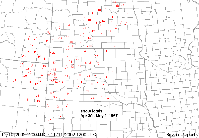
deaths in Minnesota. While tornadoes were wreaking havoc, a blizzard
was raging across the northern plains. Some
details of the
most prominent tornadoes on this day are given below.
Major Tornadoes
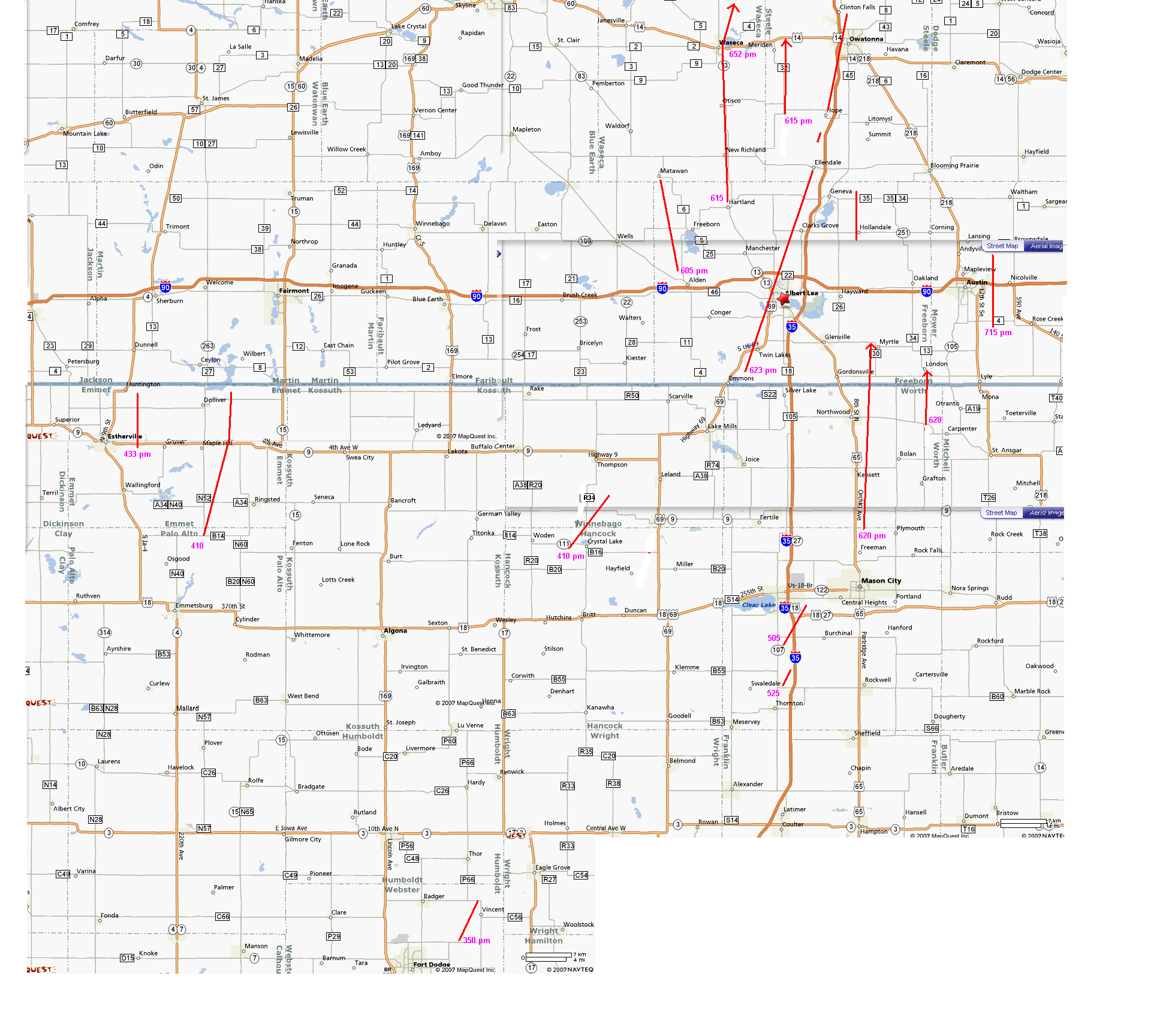
The Alden-Matawan Tornado
A tornado
moved north-northwest from just northwest of Alden, MN at 605 pm to
near Matawan. Farm damagewas near F4
at the beginning of the
path. Homes and barns were destroyed. Two people were killed.
The Hartland-Waseca tornado
A tornado developed near Hartland around 615pm and moved due north into the town of Waseca. This funnel was in contact
with the
ground 90% of the time. After hitting Waseca the tornado moved
north-northeast and ended 7 miles nne of Waseca.
The tornado
followed highway 67 into town and destroyed farm buildings on both
sides of the highway. The tornado cut a
4-block path
into town, destroying 16 homes, 6 of which were leveled.
Twenty-five other homes were heavily damaged. This
tornado is
rated F4 in "Significant Tornadoes" by Tom Grazulis. Six
people were killed near Waseca.
Another
tornado paralleled this tornado about 4 miles to the east--moving from
west of Lemond at 615 pm to west of
Meriden. Barns were
destroyed. It is not known if this was the same storm that produced
these tornadoes. Based on the
times, the 2nd
tornado seemed to have lagged behind the first tornado and may have
been produced by a different storm.
The Manly-Mrytle Tornado
A tornado
moved slightly east of due north from 2 miles southeast of Manly,
IA(620pm) to near Myrtle, MN. This tornado
destroyed 10
farms, levelling some of them to the ground in near-F5 fashion. Ten
other farms, mostly in Iowa were
extensively
damaged. There is conflicting information about the time of this
tornado. Were there 2 tornadoes back to back,
one at 530 and another at
630 pm or is storm data in error?
The Albert Lea-Owatonna tornado
A tornado
moved north-northeast from southwest of Twin Lakes(623 pm) to the
western suburbs of Owatonna. Farms were
leveled at 6
locations along the path. There was $2,000,000 damage in Albert Lea
where 26 homes were destroyed
and 64 badly
damaged. Two people were killed close to Owatonna near the end of the
path with 5 deaths total.
The London tornado
A tornado
moved north(628 pm) from south of the Minnesota state line to near
London, MN. Six farms were extensively
damaged and at least 2 farm homes were destroyed.
Other Tornadoes
A tornado touched down around 4 pm east of Gruver, IA and moved north to near Huntington. One barn was destroyed
and 6 others
were damaged.
A tornado moved northeast(410 pm) from 1 mile west of Crystal Lake, IA to west of Forrest City. Buildings were damaged
or destroyed on 8 farms.
Three farms lost all the buildings except the homes.
A tornado moved north-northeast(410 pm) from 8 miles north of Emmetsburg. Homes were unroofed near Halfa and barns
were destroyed east of Gridley.
A
tornado moved northeast near Vincent, IA around 350 pm.
A
tornado touched down near Hollandale, MN and moved N, lifting east of
Geneva.
A tornado
touched down(715 pm) on a farm 1.5 miles southeast of Austin, MN and
moved north for 6 miles. At least 2 barns
and 1 farm
home were unroofed and torn apart.
A
tornado touched down around 810 pm and moved north from near Marion to
northeast of Eyota. A trailer andbarn were
destroyed.
Synoptic Sequence of
events
At 12 UTC
April 30 1967, a very strong upper level trough was beginning to eject northeast across the southern high
plains. A 700mb warm pool stretched up and down the plains from north Texas to Omaha, NE. The 700mb temp.
at Omaha was
+9C which is very warm by late April standards. However, mid-level cold
advection was noted
across the
southern high plains and southern Rockies. The 700mb temps. were down
to 5C at Amarillo and 3C at
North Platte.
A 850mb moist tongue extended from eastern Oklahoma into central and eastern Iowa with 850mb
dewpoints at
least 12C.
The 18 UTC surface map showed a deep surface low in central South Dakota with a cold front stretching from eastern
Nebraska to
north Texas. As is common with strong and developing storm systems,
several areas of low level
frontogenesis
were present across northern Iowa and southern Minnesota. A nearly
stationary boundary(#1) stretched
from south of
Mankato, MN to south of Green Bay, WI. Air north of this boundary was
much too stable for surface
based
convection. Another surface boundary(#2) stretched from north of Sioux
Falls, SD to south of Waterloo, IA to
north of
Moline, IL. Air north of this boundary was only marginal unstable with
fairly cool temperatures and modest
temperatures
and modest dewpoints. A warm front(#3) extended from south of Sioux
Falls, SD to near Des Moines, IA to
north of
Kirksville, MO. The airmass along and north of this boundary was
extremely unstable with low LCL heights.
South of this
boundary the LCL heights were much higher but it was still very
unstable due to the warmer temperatures.
By 21 UTC the northern most boundary was still in roughly the same position. The southern boundaries had progressed
north.
The 23 UTC surface map showed the surface cold front charging into southern Minnesota and north Central Iowa.
The 3
aforementioned boundaries intersected near a surface low just southwest
of Mankato, MN.
By 00 UTC May
1 1967, a very intense upper system was centered just north of
North Platte. This system obviously
underwent
development since 12 UTC as the 500mb height near the center of the upper low dropped from 540dm
to 528dm and
was centered near Valentine, NE. The 500mb wind at Omaha was 110kts so
a very strong jet
streak was
associated with this system. The 700mb chart showed cold advection acros the central and southern
plains. The
700mb temp. had dropped from 9C to -4C at Omaha in 12 hours and from 9C
to -1 C at Topeka.
The leading
edge of the 700mb cooling was across central and western Iowa at 00 UTC
or roughly coincident
with the surface cold
front. The 850mb moist tongue had shifted east and extended from Illinois north-northwestward
into central and eastern
Iowa and southeast Minnesota.
The following
sequence of "zoomed in" surface charts from 18, 21 and 23 UTC show the
different airmasses in places
across
northern Iowa and southern MN on April 30 1967.
21 UTC
23 UTC
00 UTC
`
High temperatures(6pm to 6 pm) from cooperative observers were used to help locate boundary positions and help
in the
determination of instability. The high temps in the Waseca/Owatonna are
were in the 63 to 66F range. Since there
was the
possibility that the max temp for the day occurred after 6 pm and
before the storms hit, I also checked the
next day max
temp to make sure it wasnt higher than the April 30 maxes. Since the
cold front passed immediately
after the
tornadoes hit, it seems logical that the max temps at the coop sites of
Owatonna and Waseca were close
to the temps
that the storms experienced. In other words, as the storms approached
Waseca and Owatonna, the
storm inflow
was fairly cool (< or + 66F). The max temp at Albert Lea was 68F but
the dewpoint was probably
not too far
behind the temperatures(mid 60sF).
Instability approximation
Surface based
instability(SBCAPE in this study) was approximated for several areas.
The first approximated
sounding is for areas immediately north of the southernmost warm front. Surface based CAPE in this area
was over 3000
/kg. The second sounding was made for areas along boundary #2 where dewpoints were very
high and
temperatures fairly cool. Surface based CAPE was around 2400 j/kg. This
sounding is probably
a good
approximation of the conditions near Albert Lea near the time of the
Albert Lea tornado. The third
sounding is probably a good approximation of the conditions near Waseca and Owatonna around the time these
towns were hit
by tornadoes. The low levels were just too stable north of these towns
for continued tornadic activity.
The
CAPE in this third sounding was around 1800 j/kg.
The above
finding show that the most violent tornadoes did not occur in the area
of highest surface based instability.
Tornadoes did
occur in northern Iowa, but these were not near as violent as the ones
further north.
Just in case
anyone is curious, I modified the Feb 12 2007 12 UTC Glasgow, MT
sounding to obtain the soundings
above. This
may seem very odd but I have a very good reason for this method. This
sounding happened to the one
sounding that
I could find in the local AWIPS database that had a starting pressure
around 940mb. 940mb matches
the station
pressure on April 30, 1967 in southern Minnesota. But how is this
possible one might ask since Glasow is
2100 ft ASL.
This is 900ft higher than the terrain around Albert Lea Minnesota
and 1000ft corresponds to about
33mb assuming
200ft ~ 6.5mb for elevations between 1000 and 2000ft. But the sea level
pressure on Feb 12 2007
was about
1020mb at Glasgow while the slp was about 986mb at Albert Lea, MN on
April 30, 1967. In other words,
the effective
elevation at Albert Lea was much higher on April 30 1967 due to the
very low pressure on that day.
Thus, instead
of the sounding starting out at 970mb(slp 1016mb), the sounding started
out at 940mb(slp 986mb).