The May 24, 1957 Tornado Outbreak
by Jonathan D. Finch
under construction
(rough draft form)
Back to Lubbock Area Tornadoes Webpage
Back to Amarillo Area Tornadoes Webpage
Back to Albuquerque Area Tornadoes Webpage
Overview
A tornado outbreak (plotted using MapQuest) occurred on May 24, 1957 from west eastern New Mexico into central Oklahoma. Like typical
plains
tornadoes, the tornadoes on this date moved from southwest to northeast
at around 30 mph. However, most
plains
tornadoes, especially those on the high plains(elev.> 3000ft),
occur in the afternoon and evening. Some of
these torndoes
occurred in the morning which is highly unusual.
Sequence of Events
The first
tornado on May 24, 1957(or at least the first documented tornado)
skipped across Roosevelt county(west
and
north of Clovis, NM) between 330 am and 430 am MST,
destroying barns in this very rural area. The
elevation
where this tornado or tornado family occurred was between
4400 and 4600ft.
There was a
gap in reported tornadoes until 1110 am CST when tornadoes were
reported 5 miles south of Bovina,
TX(Parmer
county) and northwest of Enochs, TX(Bailey county). The tornadic storm
in Parmer county moved
northeast over mostly rural country to north of Amarillo,
occasionally touching down. Rural farm families were
huddled in
storm cellars all across west Texas. This tornado swept away buildings
on 8 farms near Friona resuilting
in $100,000
damage. The only injuries were in traffic accidents as funnels formed
over Hereford. Homes were also
damaged near
Black. The tornado northwest of Enochs moved east-northeast across Lamb
county and into northern
Hale county
but lifted before hitting Plainview. The most extensive damage with
this tornado was around Olton
where 77 homes
were destroyed in the south part of town. Southwest of Olton a car was
thrown 1/2 mile. Homes
and
barns were torn apart north of Halfway, TX and livestock killed.
Total damage was $650,000. Most of the path
of this
tornado was across rural country. Those in the path of the storm were
well warned and took shelter.
A tornado
moved northeast across desolate areas of the Texas panhandle. At 1117
am, a tornado was spotter 20
miles
northwest of Wildorado or between Boys Ranch and Vega. This tornado hit
nothing. This tornado may have
started
further southwest in desolate Deaf Smith county before 11 am.
The next
tornado touched down in Lynn county with first damage near Tahoka
around 1 pm. This tornado skipped
north-northeast. Roof damage occurred in Tahoka. Four homes were
damaged in Wilson. Four homes were destroyed
in Slayton. At
Savage, 12 homes were completely destroyed and many others damaged. The
tornado family ended east
of Cone.
A
tornado began in Hale county near Cotton Center around 130 pm.
This tornado also dissipated before hitting
Plainview.
The tornado affected rural areas around Hale Center and
ended just southwest of Plainview. A house
2 miles north
of Cotton Center was moved 100 ft off its foundation and disentigrated.
Three homes were unroofed
or torn apart
at the end of this tornado(southwest of Plainview).
A tornado
moved northeast from 8 miles west-northwest of Midland to the Lenora
community between 2 pm and
3 pm. Moving
over rural country, 50 power poles were downed nw of Midland. Farm
homes were reported as
destroyed 10
miles northwest of Stanton in southern Martin county. At Lenorah, 5
homes were hit with 1 destroyed.
A tornado
touched down 10 miles nnw of Midland at 629 pm and moved over rural
country. Another tornado
touched down
just se of Midland around 630 pm and was reported again 15 miles east
of Midland at 705 pm.
These
tornadoes did not cause enough damage to be listed as significant
tornadoes.
Funnels were
seen near Vernon, TX from 350 pm to 410 pm. A tornado was reported from this storm in
southwest Tillman
county at 430
pm from this storm.
A tornado
moved northeast from east of Apheatone(west of Walters) at 530 pm to 7
miles southeast of Lawton. Two
couples were
killed as their homes were leveled to the ground. About 12 homes were
destroyed. About 70 cows were
killed. A
car was carried 100 yards into a pond. This tornado
began around 530 pm. The tornado was reported 5 miles
s of
Lawton at 550 pm and was causing F4 damage at this time.
Several farms were completely destroyed.
A tornado
moved north-northeast then due north from southwest of Winnewood to
east of Pauls Valley to Wanette to
6 miles
northwest of Macomb. The tornado was located 5 miles southwest of
Winnewood at 603 pm, 14 miles east
of Pauls
Valley at 640 pm and 710 pm at Wanette. This tornado was still visible
at 725 pm.
Tornadoes were
reported northwest of Seymour, TX at 815 pm and 20 miles north of
Throckmorton, TX at 850 pm.
Tornadoes also occurred
around Duncan, OK between 9 pm and 11 pm with F2 damage officially.
Synoptic Sequence of Events
A tornado occurred in the
Nebraska panhandle on May 19, 1957. Severe weather that day was aided
by cold temps
at mid and upper levels
along with marginal low level moisture in the southern and central
plains. I must add that
although
moisture was marginal, moisture on the central high plains was very
good for late May standards with
upper 50sF dewpoints as far west as Sidney and Scottsbluff, NE. However, the front barely made it through
Brownsville,
TX early on May 19. By late on May 19, mid 70sF dewpoints were surging
back through Brownsville.
The Gulf of
Mexico was in equilibrium and from May 20 through May 24, gulf moisture
would return unimpeded
into Texas.
The Gulf of Mexico was not really open for business until May 20. A tornado outbreak occurred in May
20 in Kansas,
Nebraska, Missouri and Oklahoma, with numerous fatalities around
Kansas City. Actually the moisture
returned at
the last minute into Kansas and Missouri on May 20 and even mixed out in some places in the warm sector
on the day of
the outbreak due to very strong low level flow above the surface and shallow moisture. But the moisture
was obviously
deep enough for violent tornadoes.
The upper
trough that caused the tornadoes on May 20 was lifting ne through the
northern plains on May 21. A violent
tornado
occurred in eastern Minnesota in association with this strong shortwave trough and deep surface low.
Violent
tornadoes also occurred in southern Missouri with 15 people killed as
lower 70sF dewpoints surged into that
area along
with 70 to 80 kts at 500mb.
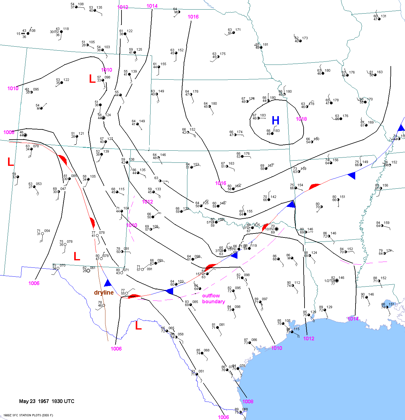
On May 22,
1957, a surface low was located over southwest Oklahoma at 18 UTC. A
front stretched from central NM
into Oklahoma
and then into Missouri. Outflow had pushed south of the front to the
Red River. A pacific cold front
stretched from
the low south to near Del Rio. The pacific cold front washed out
over the next 12 hours. However,
the other
front pushed south through all of West Texas and eastern NM by 18 UTC May 23. Outflow had outrun the
front in
central and east Texas. Surface dewpoints were from 70 to 75F in
the Texas warm sector. The dewpoint was still
57F and 59F
well north of the front at Lubbock and Childress.
By 00 UTC May 24, dewpoints were above 60F at Midland and were on the rise across West Texas. The dewpoint
was holding at
57F at Lubbock. 60F dewpoints were located as far north as
Oklahoma City and Childress, TX.
The front was
located from south of Fort Stockton, TX into the DFW area and then
northeast into northern Arkansas.
A large
convective cluster had forced the effective warm sector well south
through Killeen, Austin and Lufkin, TX.
Dewpoints in
the south Texas warm sector were quite high from 73 to 77F.
However, the dewpoints were starting to
get very high
even on the higher terrain of the Edwards Plateau region(above 2000ft
elev.) at San Angelo(67F) and
Junction(70F).
By 06 UTC May 24, rich gulf moisture was surging back into southeast NM on both sides of the warm front. The
dewpoints were
up to 65F at Midland, 63F at Hobbs and 61F at Carlsbad. San Angelo has
a 70F dewpoint with surface
winds fron the
east-northeast. The dewpoint at Lubbock was up to 59F.
The 12 UTC surface chart showed that dense fog had developed from upslope and moisture advection in west Texas as
as far north
as Amarillo. Surface dewpoints were up to 63F at Roswell, 66F at Hobbs,
66F at Carlsbad and 68F at
Midland. These
are extremely high dewpoints for this area. Lubbock was socked in with
fog with 61F/61F T/TD and
east winds at
20 kts. Upper 60sF dewpoints were not far southeast of Lubbock at
Snyder, TX(67F).
By 15 UTC May 24, the surface dewpoint was up to 64F at Lubbock with 3/8 mile visibility in fog and 20kt east-southeast
upslope flow.
The T/Td was 69F/63F at Clovis, NM at 15 UTC at 863 mb with
lifted index of -10 to 11 and CAPE of 3500 j/kg.
The
approximate sounding for Clovis, NM can be found here.
The storms
that produced tornadoes in west Texas in late morning and early
afternoon were probably initiating around
1630 UTC. The reason I say this is because the surface winds were already veered at Tucumcari and Clovis(Cannon AFB
on the
west side of Clovis) by this time with the moisture axis shifting
east. I suspect that the storm that produced a tornado
near Bovina at
1110 am developed south of Clovis along the dryline, becoming quickly
tornadic upon crossing the warm
front. The
storm that produced the tornado south of Muleshoe, TX at 1110 am
developed in the vicinity of Clovis around
1030 am and
also became quickly tornadic after crossing the warm front. The storm
that produced a tornado 20 miles
northwest of
Wildorado, TX at 1117 am probably developed north of Clovis around 10
am. The T/TD was 68/67F at
Reese AFB at
1630 UTC with lifted index of at least -9 and CAPE of 3000/j/kg. The approximate sounding for Lubbock
for 16 UTC can
be found here.
At 1730 UTC, as tornadoes were roughly near Friona and southeast of Sudan, the T/TD at Reese AFB was 72F/67F
with 70F/67F
at Lubbock.
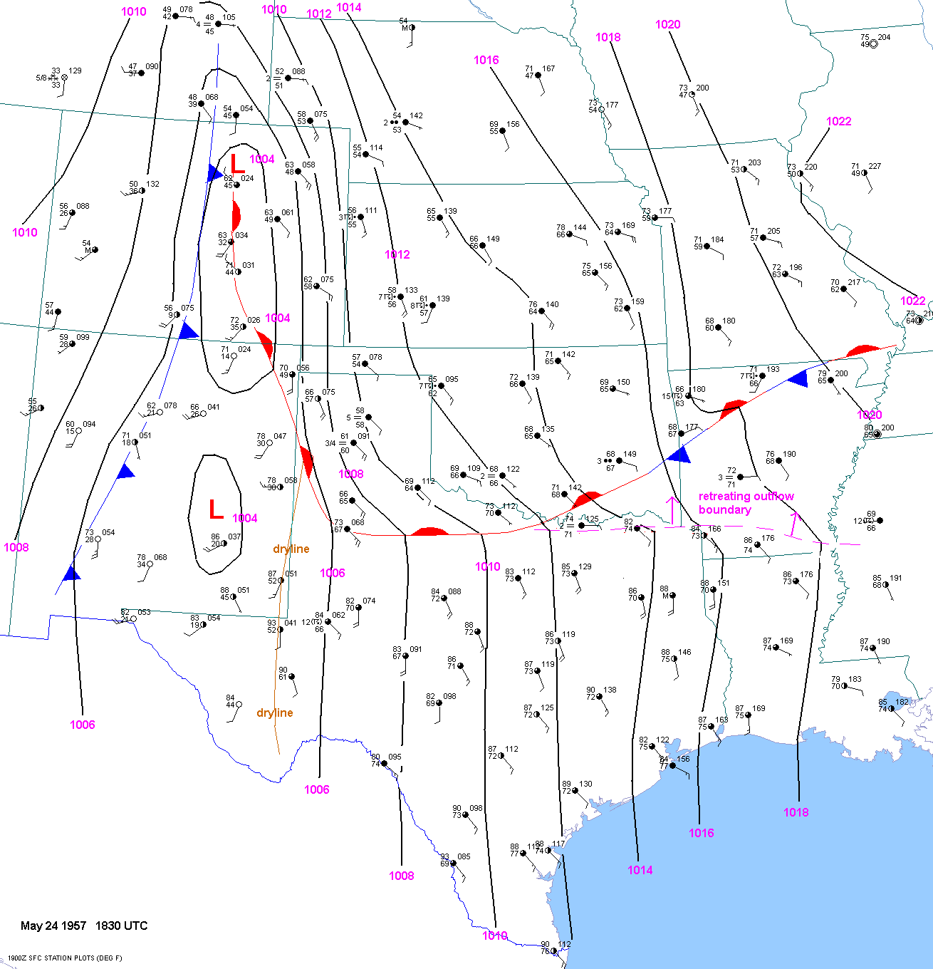
At 1230 pm(1830 UTC) as the tornado was wreaking severe damage at Olton, TX, the T/TD were up to 73F/67F at
Lubbock(35
miles to the southeast). Lubbock was just breaking out of the fog with
the warm front about to move through.
So it appears
that the Olton tornado occurred just north of the warm front with
very low dewpoint depressions and backed
surface winds.
All the tornadoes that occurred in west Texas and the Texas panhandle
from 11 am to 2 pm(excluding the Lynn/
Crosby county
tornado) occurred immediately north of the warm front with low dewpoint
depressions, backed surface winds
and surface
based CAPES over 3000 j/kg.
Tornadoes also
occurred in the warm sector near Midland and east/southeast of Lubbock
between 1 pm and 9 pm. These
storms
occurred..... to be completed at a later time.
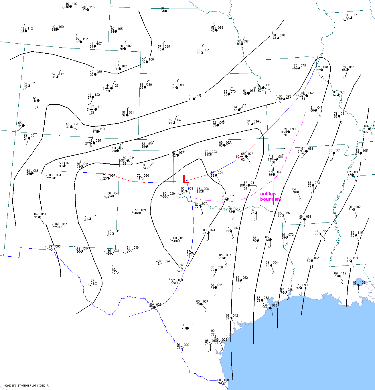
Storms also
developed along the warm front south of the Red River around 3
pm(21 UTC). These storms moved northeast and
became
tornadic. The surface chart showed T/TD values of about 80F/74F along
the warm front and 76F/74F just north of the warm
front ahead of
the storms. Mid level temps were considerably warmer for these storms
than for the earlier storms northwest of
Lubbock and
southwest of Amarillo. But surface based lifted indices were still
between -10 and -11 with surface based CAPES
over 3000
j/kg. Obviously the high surface dewpoints made up for the warmer mid
level temperatures.
500mb charts
15 UTC May 24
21 UTC May 24
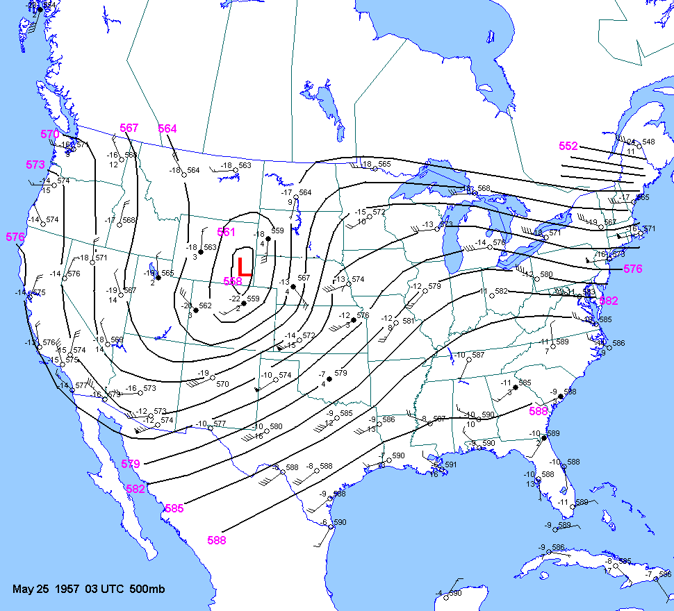
03 UTC May 25
700mb charts
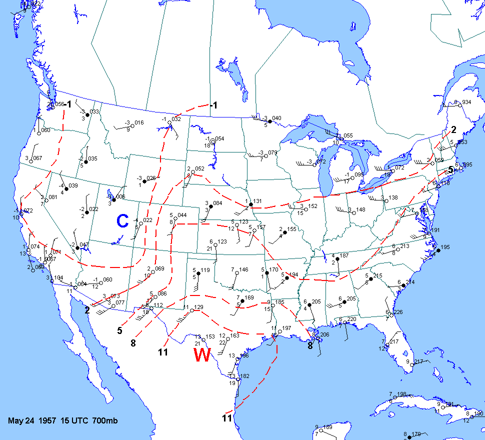
15 UTC May 24
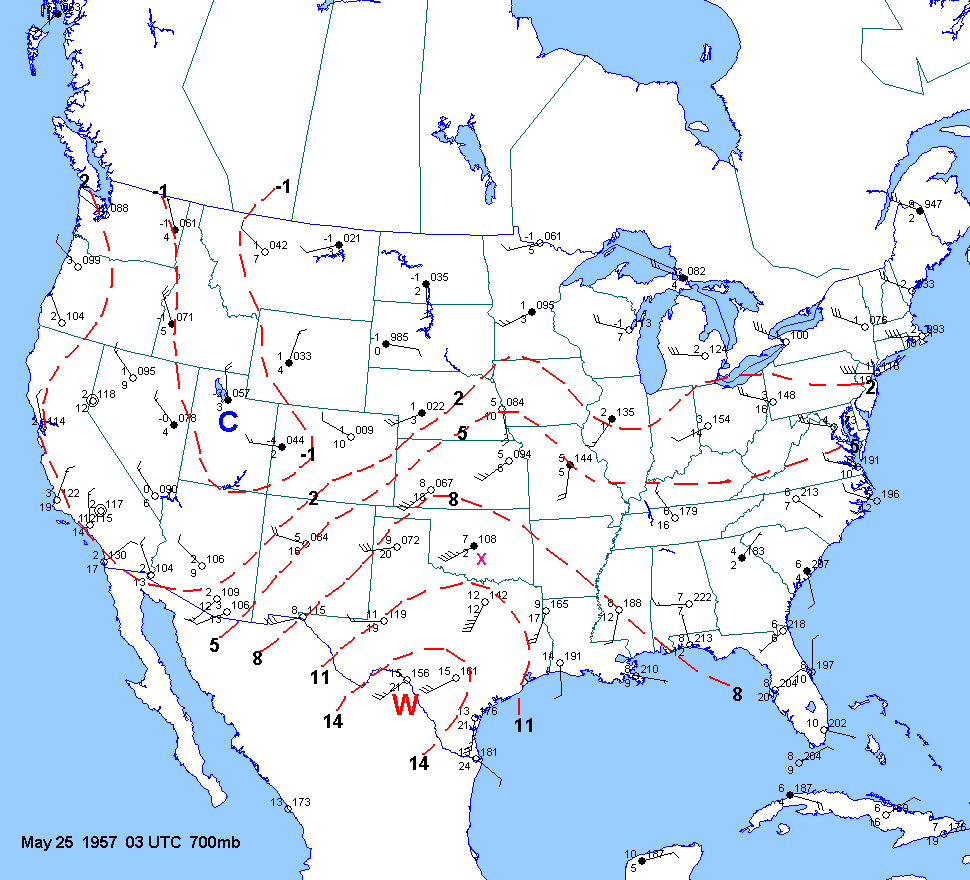
03 UTC May 25
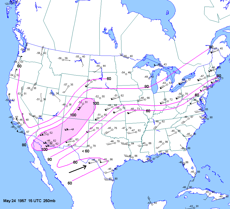
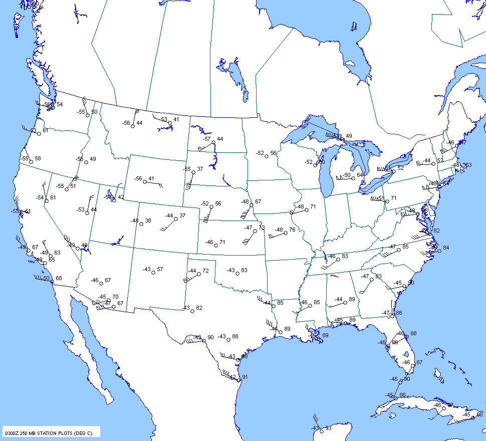
250mb charts
15 UTC May 24
03 UTC May 25
Surface Charts
1830 UTC May 22
1830 UTC May 23
0030 UTC May 24
0630 UTC May 24
1230 UTC May 24
1530 UTC May 24
1630 UTC May 24
1730 UTC May 24
1830 UTC May 24
2130 UTC May 24
When one
think of upslope flow on the high plains, west Texas is usually not the
first place that comes to mind. I tend to the
McCook-Sidney-Cheyenne-Scottsbluff corridor southward into northeast
Colorado. But upon inspection of a topographic map,
one
can readily see that southeast
to east to northeast low level flow in the Lubbock area
is definitely
upslope. In fact, upslope
flow in west
Texas can have a dramatic
impact
on weather conditions. Air that flows westward from
Hall, Cottle, King, Stonewall
and
Childress counties onto the "Caprock"
has to ascend about 1200-1500ft in 25 to 50
miles. The elevation gradient is not
as great in
the Texas panhandle to the north and Edwards
Plateau to the south. This can lead
to higher surface pressures, cooler
temperatures
and
higher dewpoint
temperatures in west Texas. Despite
the
"coolness" of the air, when the sun breaks out along
the southern
edge
of such an airmass it can become very unstable.