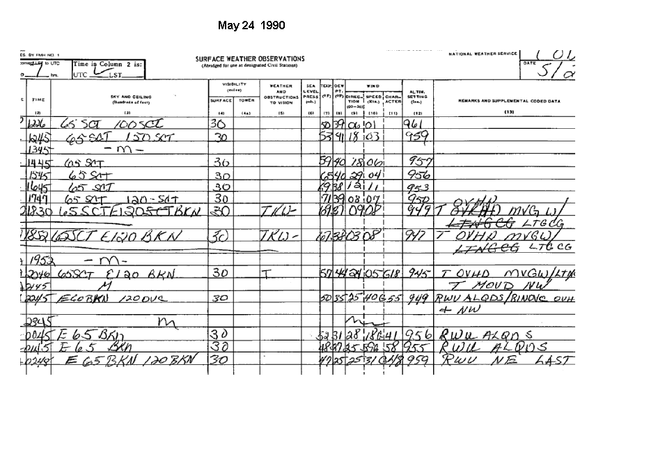
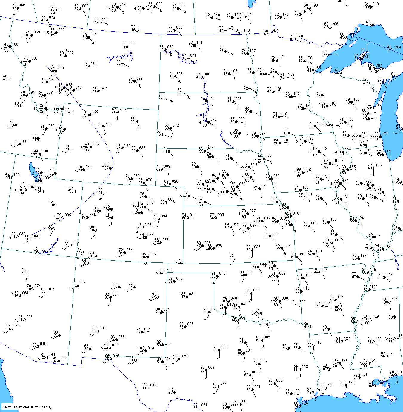
Meteorological Discussion
Evening Before
A deep 500mb trough was developing across the
western United States on May 23. Ahead of this feature, a
700mb warm
plume was located over the central and southern
Rockies with 700mb temperatures from 12 to 15C.
A weak frontal boundary was located across
southern
Nebraska. North of this boundary, upslope flow was
transporting moisture into the Nebraska
panhandle and eastern Wyoming.
This initial surge of moisture was probably
quite shallow. Indeed, dewpoints started to fall
after sunset into the
upper 40s at Douglas and Gillette. The 00 UTC
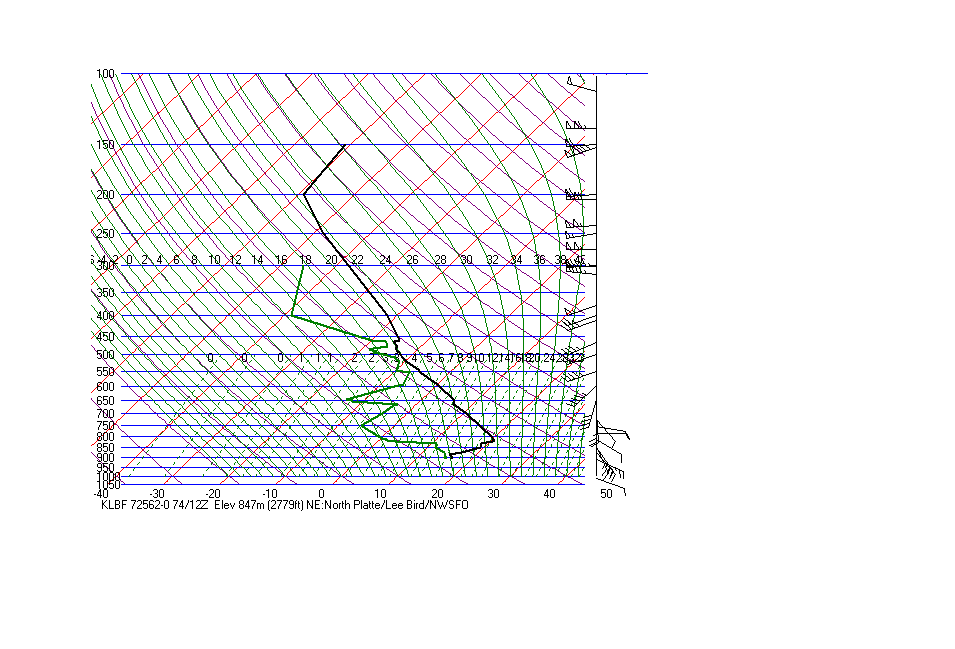
North Platte sounding showed some deep
moisture, but actual mixing ratios
were not all that high. A frontal boundary
was moving slowly southwest in central Wyoming. By 03 UTC, the surface cold front associated with the deep,
western US through was moving through Nevada. A
front was also pushing east
into Montana, western Wyomimg
and southern Utah.
Early Morning May 24
The pacific cold front was progressing into eastern Nevada by 06 UTC. The front that was moving through Montana,
western Wyoming and southern Utah was beginning to
become stationary. A surge of moisture began overnight from
far southwest Nebraska and northwest Kansas into
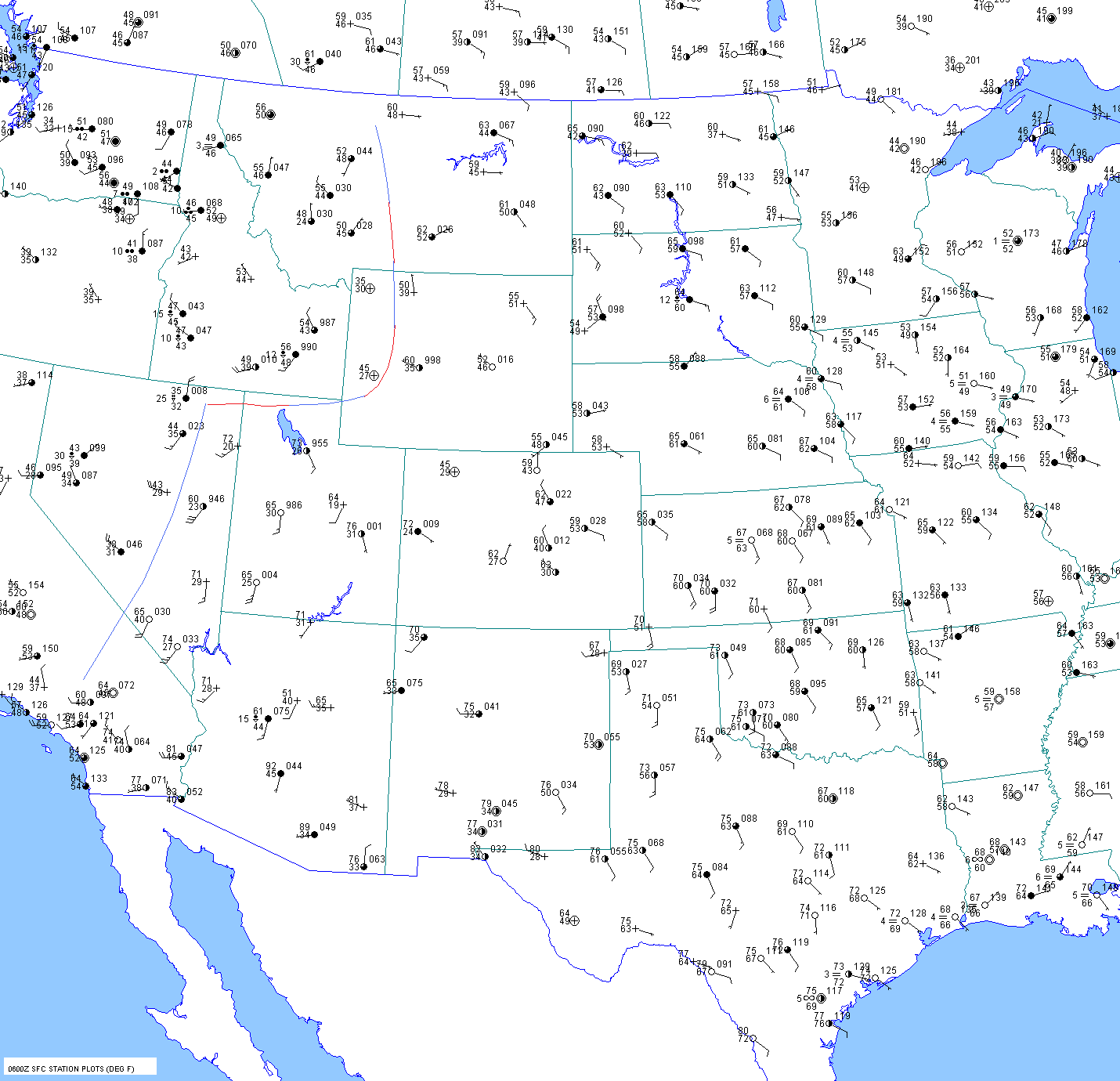
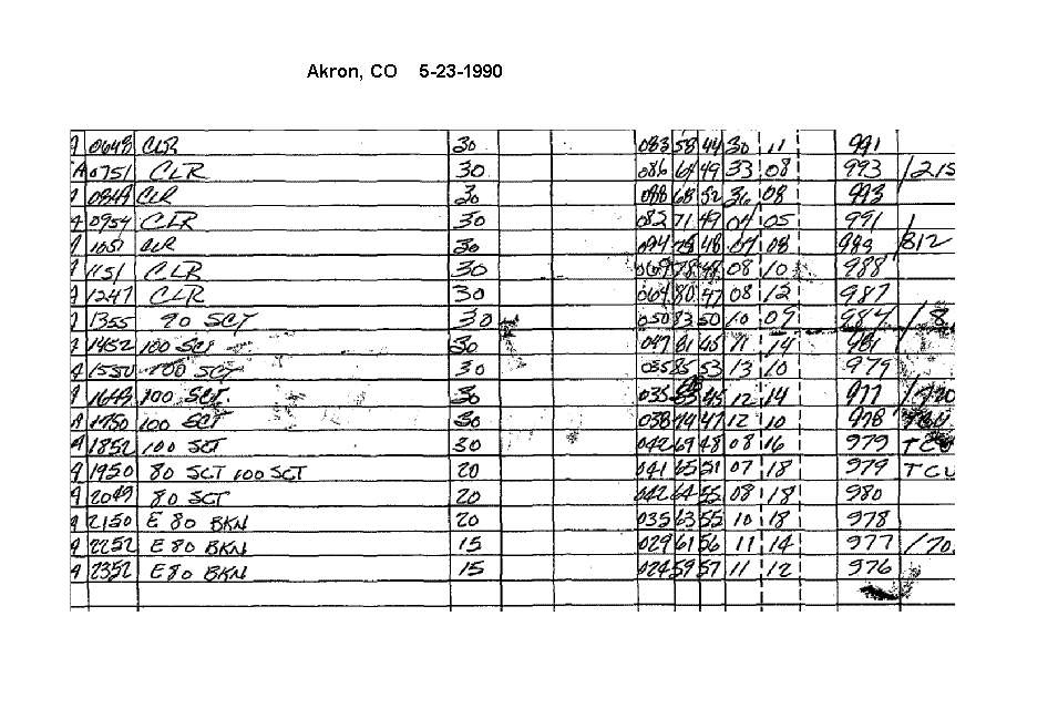
northeast Colorado. At 06 UTC, the dewpoint at Akron was up
to 56F. This
was probably deeper moisture return.
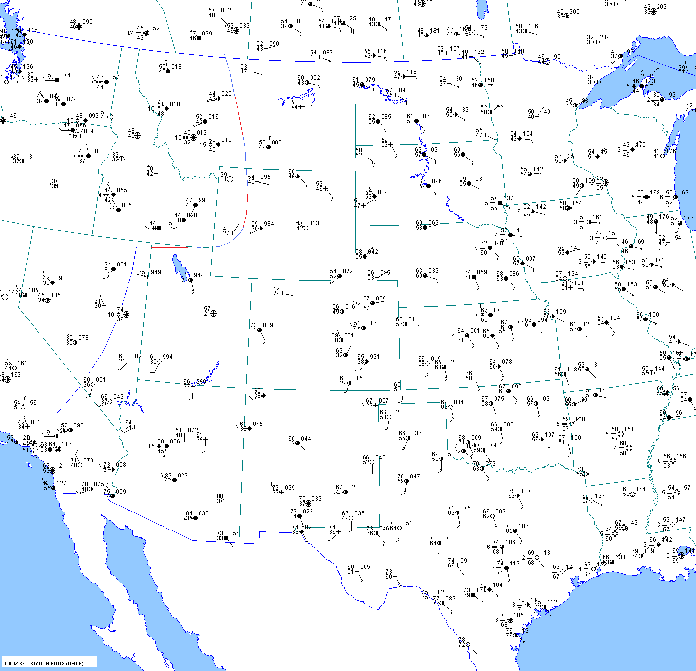
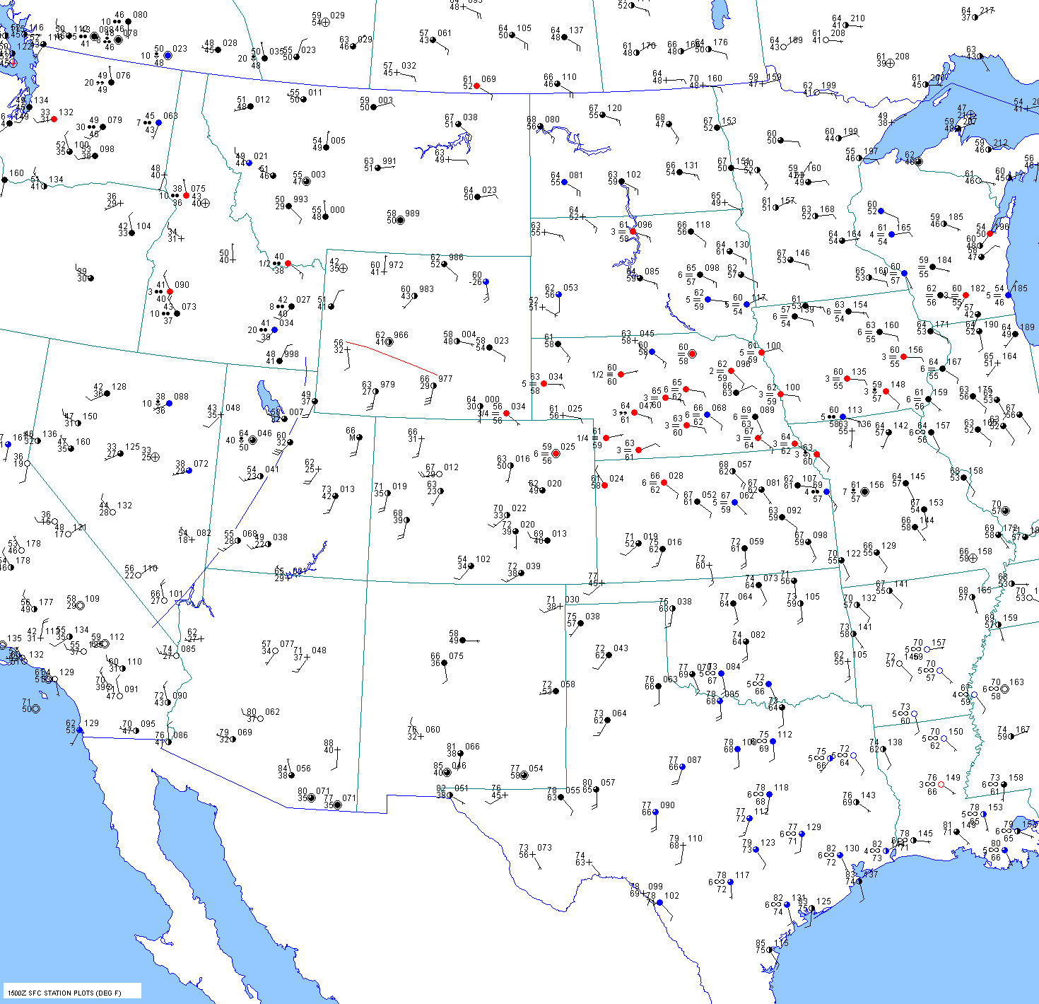
The 09 UTC surface chart shows the pacific cold front in eastern Nevada. Low level moisture was pushing into Akron
where the surface dewpoint was up to 57F, along with
advection fog.
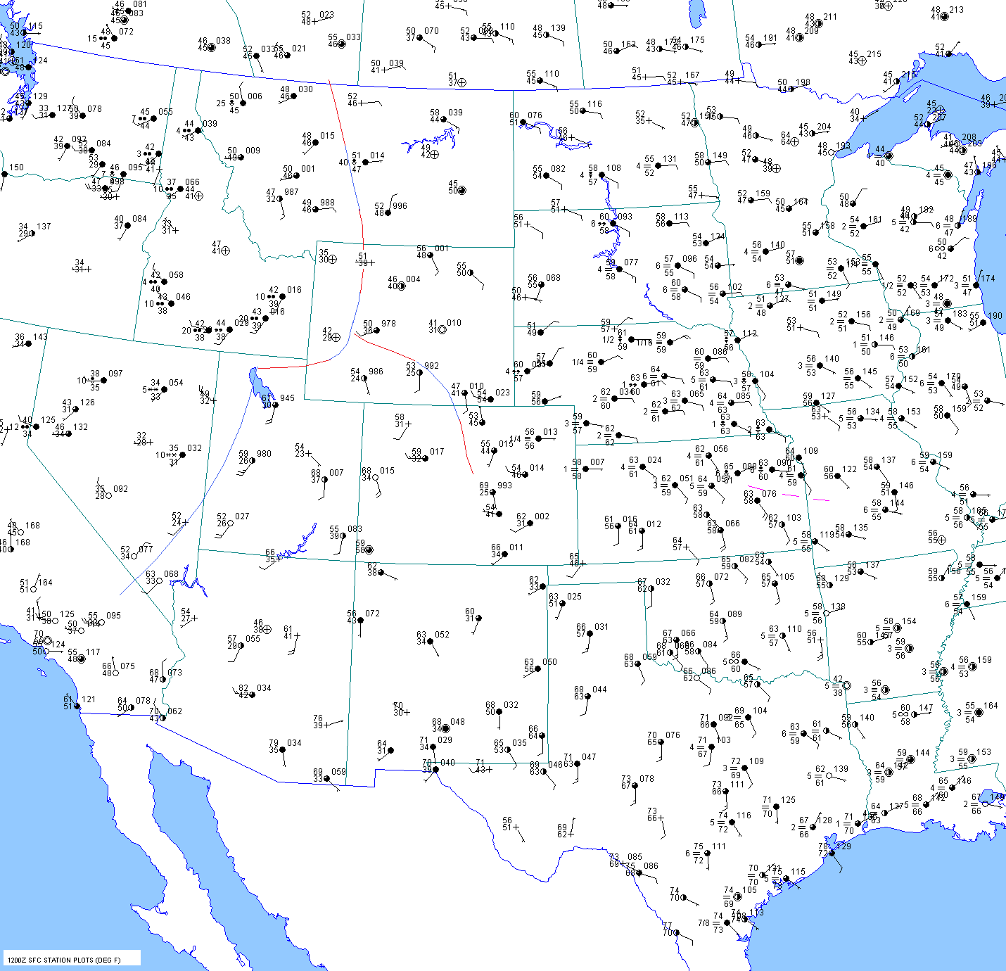
By 12 UTC, respectable surface dewpoints in the upper 50sF were present all
the way west to Scottsbluff and Akron.
The 12 UTC North Platte sounding showed shallow
moisture, but it was
probably deeper to the southwest and west
of North Platte.
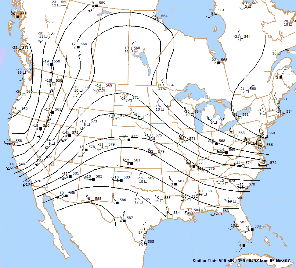
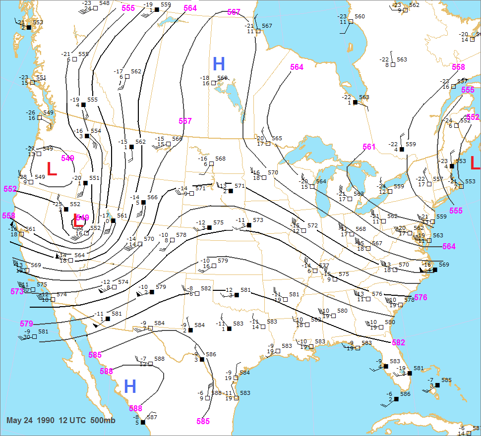
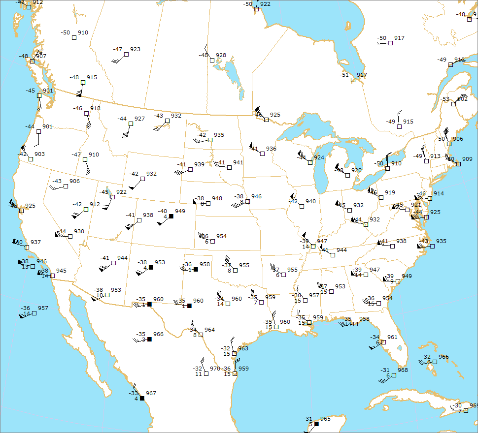
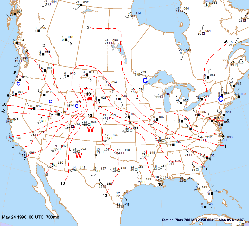
The 12 UTC 500mb chart showed a very strong shortwave trough centered over northeast Nevada (547 dm). Two
areas of strong flow were noted, one from San
Francisco into Las Vegas (55kts) and another (60-65kts) in New
Mexico and
Arizona.
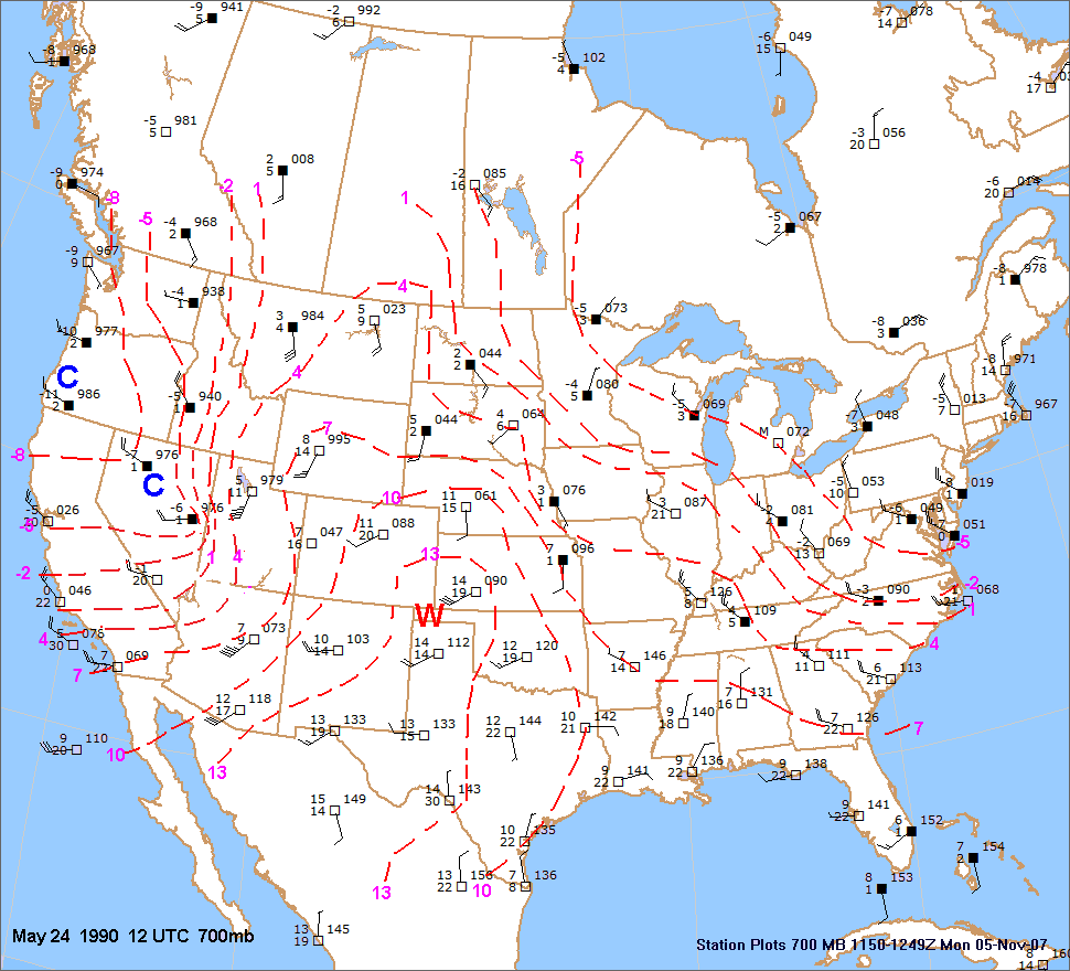
The 700mb warm plume had shifted east into the
central and southern plains overnight. This is very typical though.
Boundary layer cooling over the Rockies leads
to cooler 700mb
temperatures by 12 UTC. The 700mb temperatures
at Dodge City and
Amarillo were both 14C.
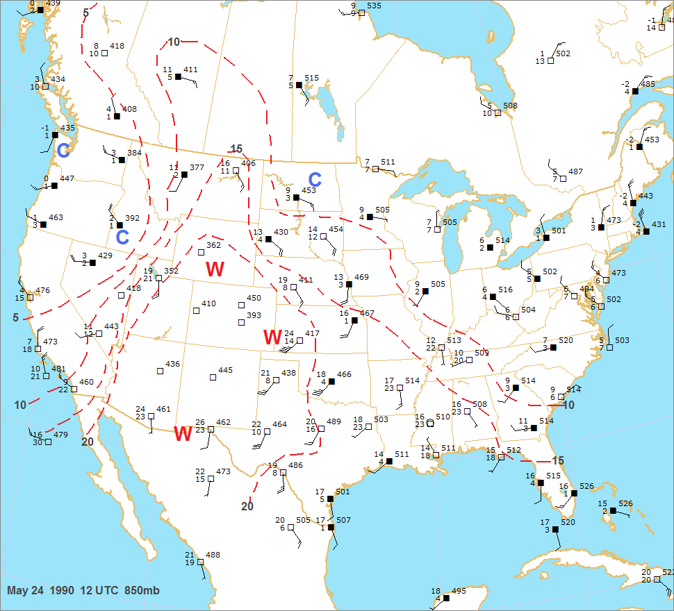
Rich moisture was noted at 850mb at Norman and
Topeka. Even though the 850mb dewpoint was only 11C at
North Platte with fairly shallow moisture, deeper moisture was likely moving upslope into northeast Colorado and
southeast Wyoming. The 300mb chart showed a broad band of
strong flow 70-80kts across the southern Rockies.
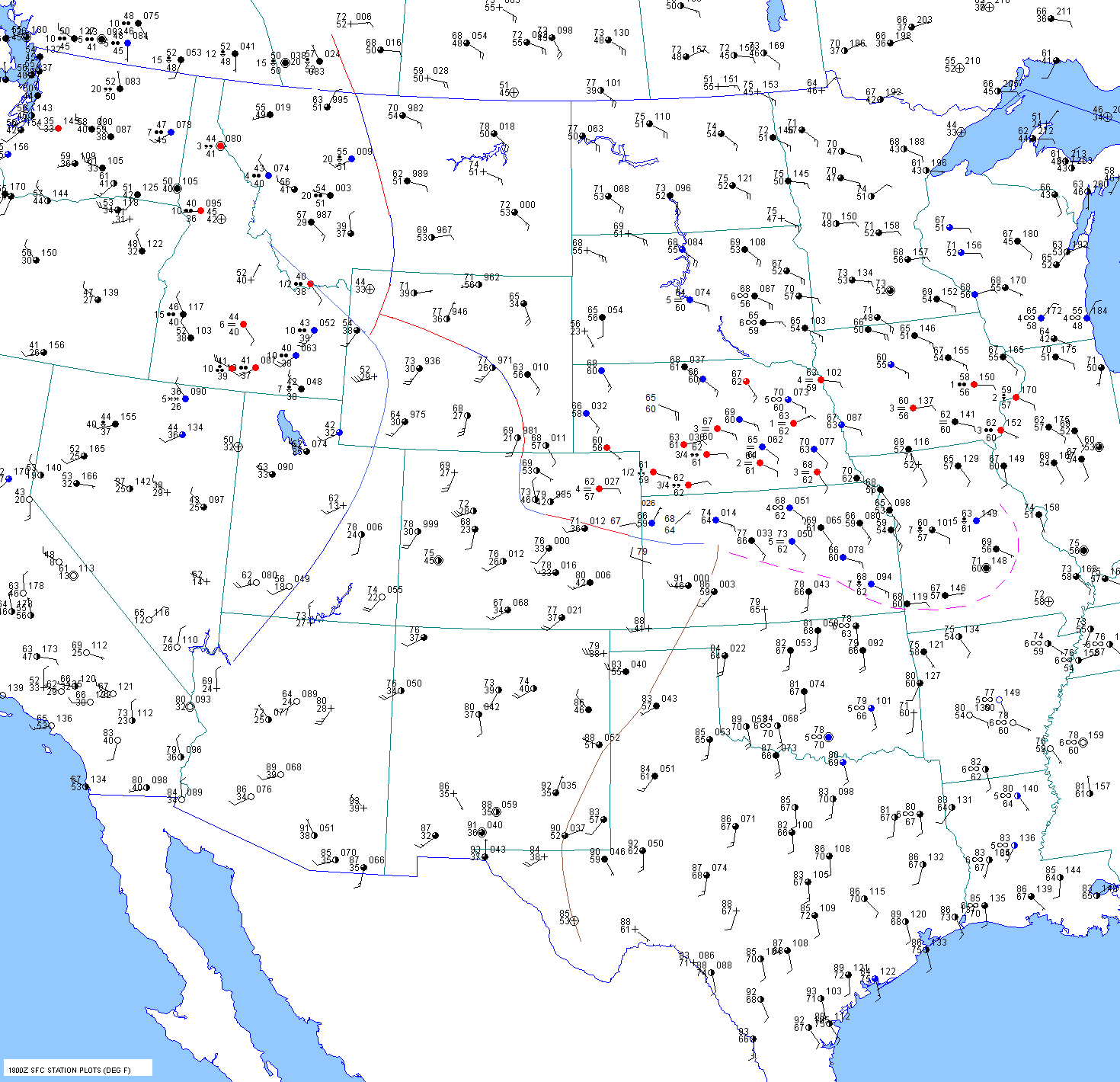
Late Morning
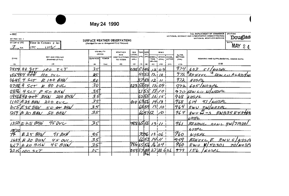
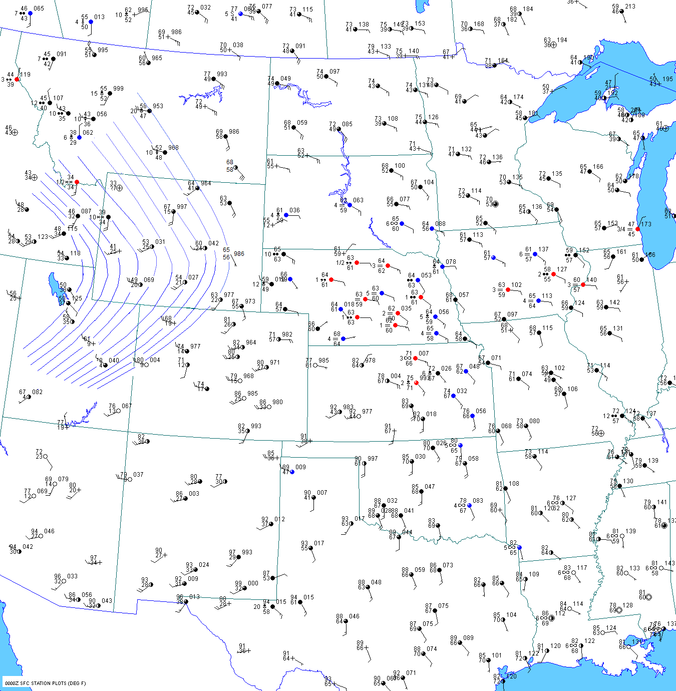
By 15 UTC, it is obvious that moisture is surging
into eastern Wyoming. One can simply look at the surface
observations from Douglas, Wyoming to figure this out. Notice
that the moisture near the ground increases first as
a 400ft sct deck of stratus accompanies an
increase in dewpoint from 48
to 53F. Then between 14 and 15 UTC,
an overcast deck appears at 4000ft AGL or 9800ft
ASL. This is about 710mb. I
suspect that this cloud deck may have
been lower than 4000ft. But nevertheless, this still
indicated an increase in
deep low level moisture. The dewpoint
steadily climbed to 56F by noon with breezy
southeast winds at Douglas. The surface
dewpoint at Cheyenne also
jumped into the mid to upper 50sF between 12
and 15 UTC.
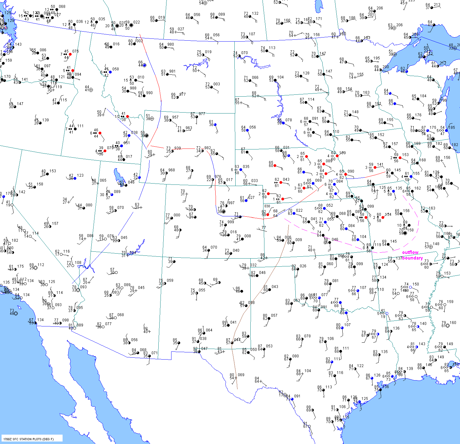
The pacific cold front was charging into central
Utah by 15 UTC.
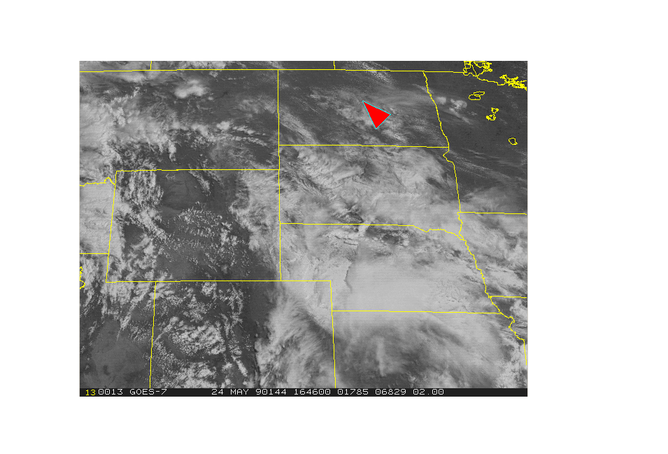
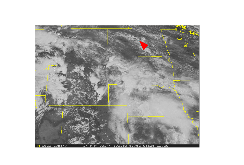
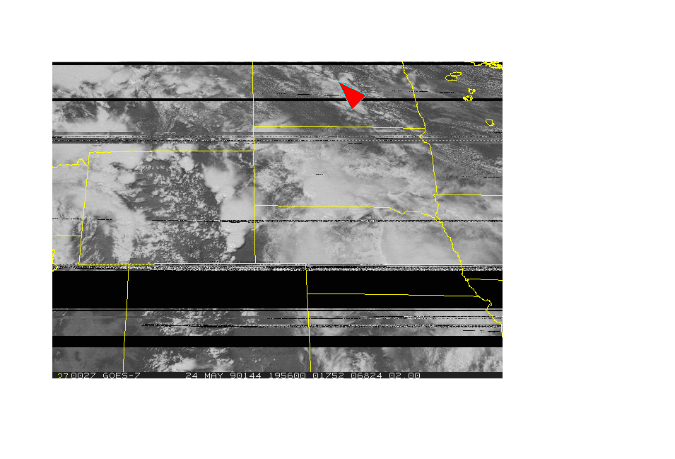
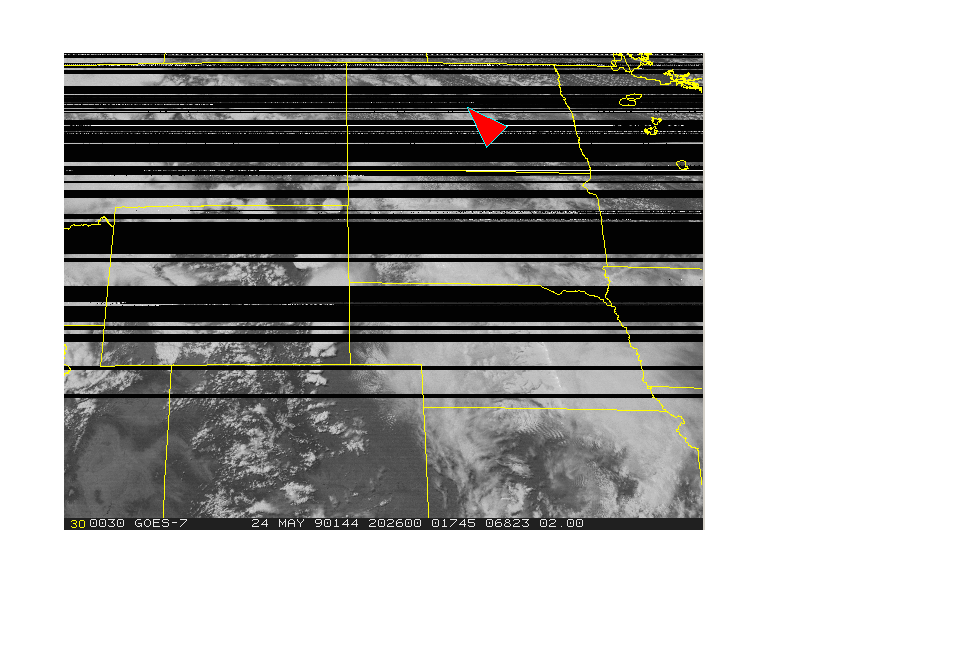
The pacific cold front was surging into southwest Wyoming at 17 UTC but was not yet through Big Piney. The
1646 UTC visible satellite picture shows cumulus clouds developing in the dry air over central Wyoming. So the low
level thermal profile must have been dry
adiabatic up through the mid levels by 17 UTC. By 17 UTC, cumulus were
developing along the edge of the low level moisture in the vicinity of Casper, WY.
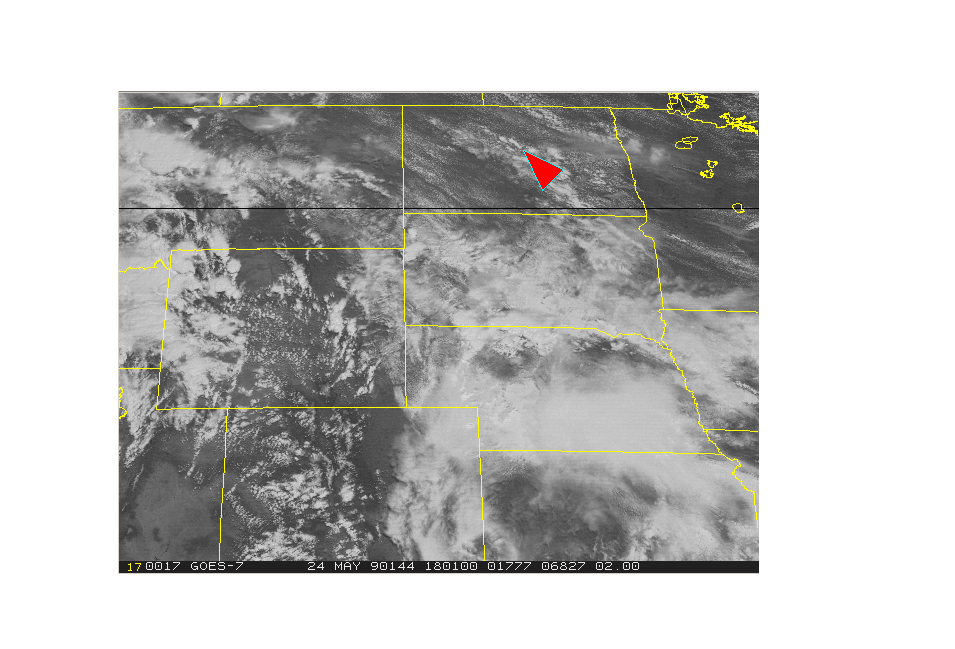
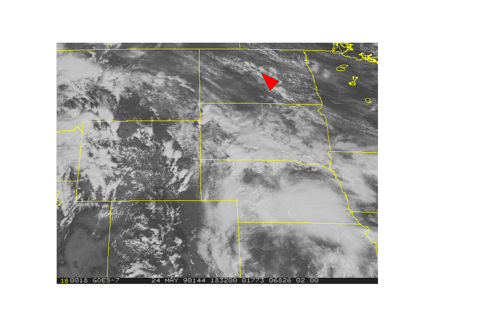
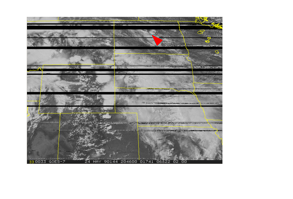
By 18 UTC (11 am MST), thunderstorms were beginning to develop just northeast and east of Casper and to the
northwest of Cheyenne along the eastern edge of the
Laramie Ridge. The 1830 UTC picture shows even more
storm
development. Storms(probably high based) were also developing on the
Big Horn mountains.
The pacific front was well east of Big Piney by 18 UTC. Ahead of this the Wyoming front was beginning to move
north as a warm front. But further east near
Casper and
between Cheyenne and Laramie this boundary was stationary.
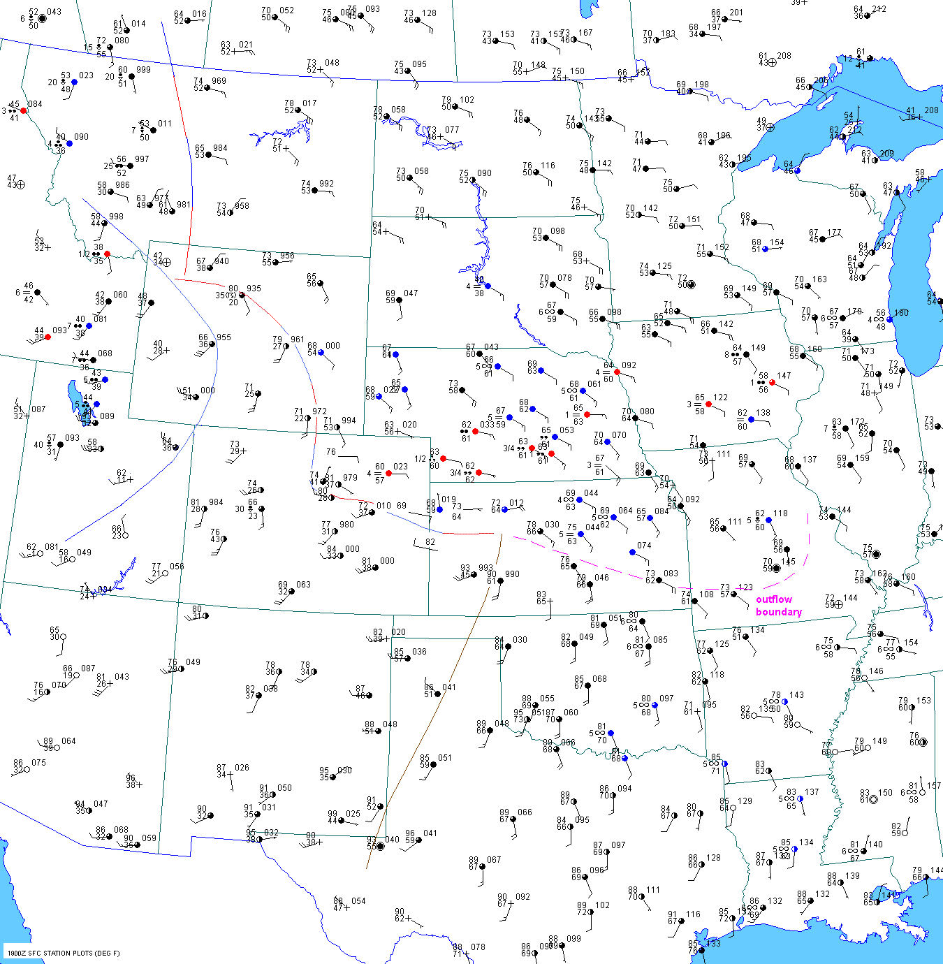
Mid-day
By 19 UTC MST, storms were developing in the immediate lee of the Big Horns. Storms were still occurring northeast
of Casper and in Platte county WY. Storms were also
developing around Cody in northwest Wyoming as the
1830
and 1852 UTC observations from Cody indicated a
thunderstorm. The pacific front at 19 UTC was already east of
Lander and Rock Springs, WY and still charging east.
Dewpoints were in
the mid 50sF at Sheridan and Billings.
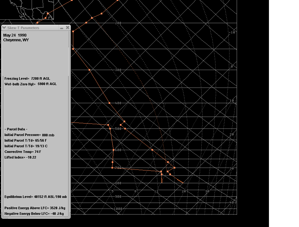
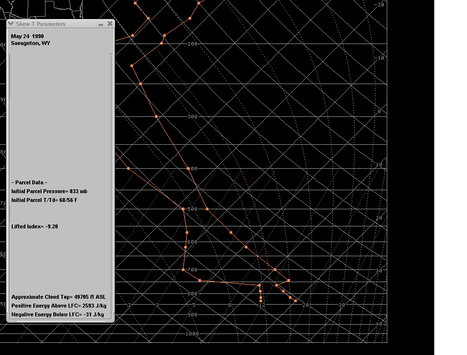
Enough instability was in place
east of the Big Horns for severe storms. The 19 UTC surface chart also
indicates
northeast
low level winds advecting low level moisture into south
central Montana and almost as far southwest as Cody.
The 20 UTC surface chart showed the pacific front still charing east through Rawlins, WY. The surface dewpoint
at
Billings was up to 55F. The elevation at Billings is only 3100 ft
though, so these values cannot be directly compared
with Cheyenne and Douglas unless we calculate
theta-e. Its is possible that lower 50sF dewpoints wrapped around
the back side of the Bighorn mountains since the surface
wind at Billings was from the northeast during the morning and
early afternoon as shown on the 17 and 19 UTC surface maps.
By 20 UTC (1
pm MST), the storms that developed near Casper were now about 40 miles northeast of Casper.
Storms were still rumbling across Platte and
northwest
Laramie counties in Wyoming.
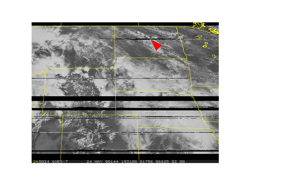
The
first severe report with these storms was a tornado at 2010 UTC just
northwest of Wheatland in Platte county.
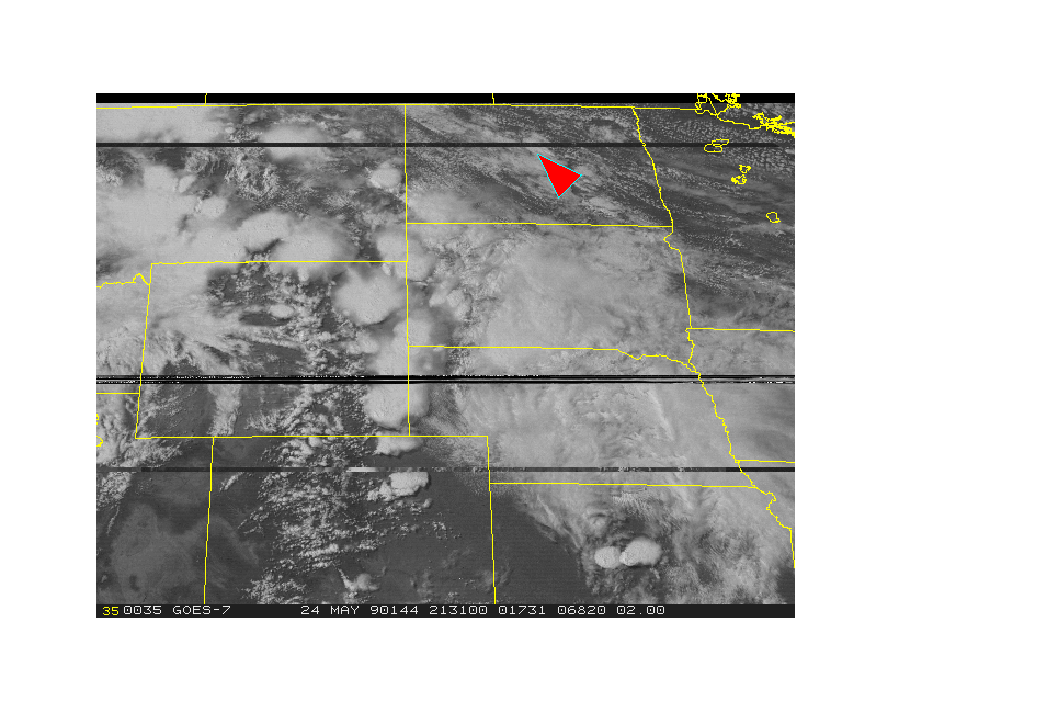
The satellite picture 15 minutes before this tornado
is here. Golfball sized hail was reported in exactly the same location
at 2030 UTC(perhaps a delayed report the same
storm?). 1 inch hail was reported east of Iron Mountain at 2030
UTC.
A tornado was reported in western Laramie
county just
east of Horse Creek at 2045 UTC. Apparently this storm
moved northeast and produced other tornadoes at 2055
UTC and 2105 UTC in wide open country with no damage.
This storm initially developed near Buford as can be
seen on the 1956 UTC visible shot.
A thunderstorm exploded in the immediate lee of the
Big Horns west of Buffalo, WY between 1930 and 2020 UTC.
This thunderstorm likely became severe but no severe
weather was experienced and reported.
The storm that developed near Cody around 1830 UTC
progressed north or north-northeast and was near close to
the Montana border by 20 UTC. Storms were
ongoing in an
arch from north of Cody to northeast of Casper to
northwest of Cheyenne at 20 UTC.
The 21 UTC surface chart shows the pacific cold front surging through Rawlins, WY.
Early Afternoon
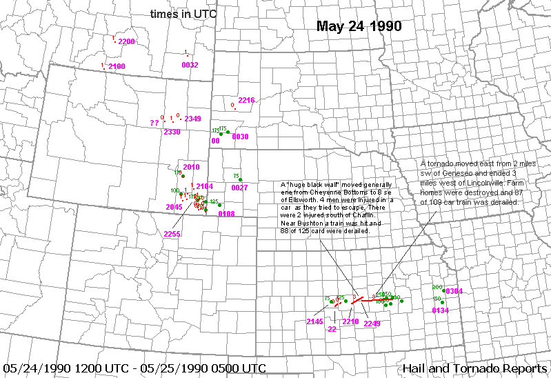
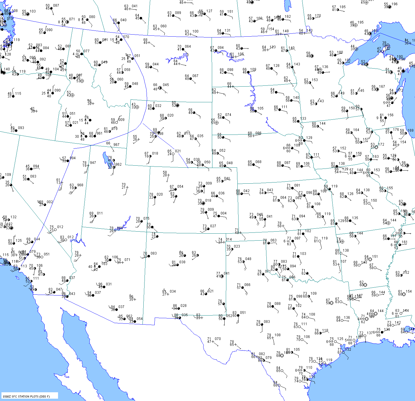
A thunderstorm erupted in southwest Kansas between 2026 UTC and 2046 UTC. By 2143 UTC this storm produced
1.25" hail and a F3 tornado occurred at 2210
UTC. A second storm developed behind the first one and produced
weak tornadoes at 2200 and 2203 UTC. Violent
tornadoes occurred with the first storm through several counties in
central Kansas. Storms also developed by 2046 UTC in
far northeast Wyoming on the west edge of the Black Hills.
The storm that developed near Cody apparently moved
into better moisture and produced a tornado in extreme
southern Montana near Warren (4400ft) at 2100
UTC. Some minor
damage (F1) was reported. Another tornado
occurred just north of Billings at 2200 UTC.
This tornado could
have been produced by the same storm although
the times indicate otherwise (60 mph storm
motion seems very unlikely).
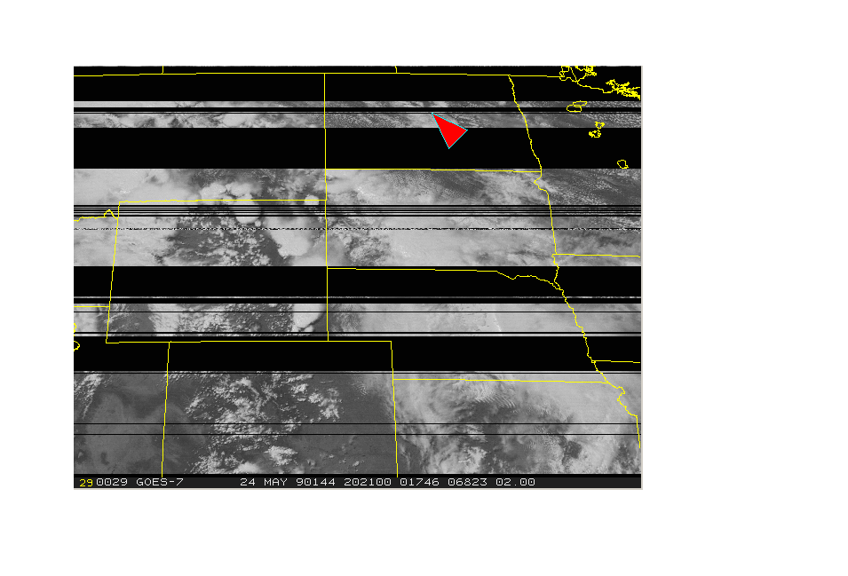
The 2131 UTC visible shot shows thunderstorms
continuing over southern Campbell county in northeast Wyoming.
No severe weather has been reported thus far with
these storms. Storms were also occurring in near the Black Hills
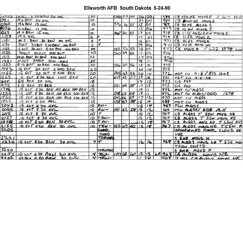
of South Dakota and over southeast Wyoming. A tornado was reported close to Ellsworth AFB at 2216 UTC.
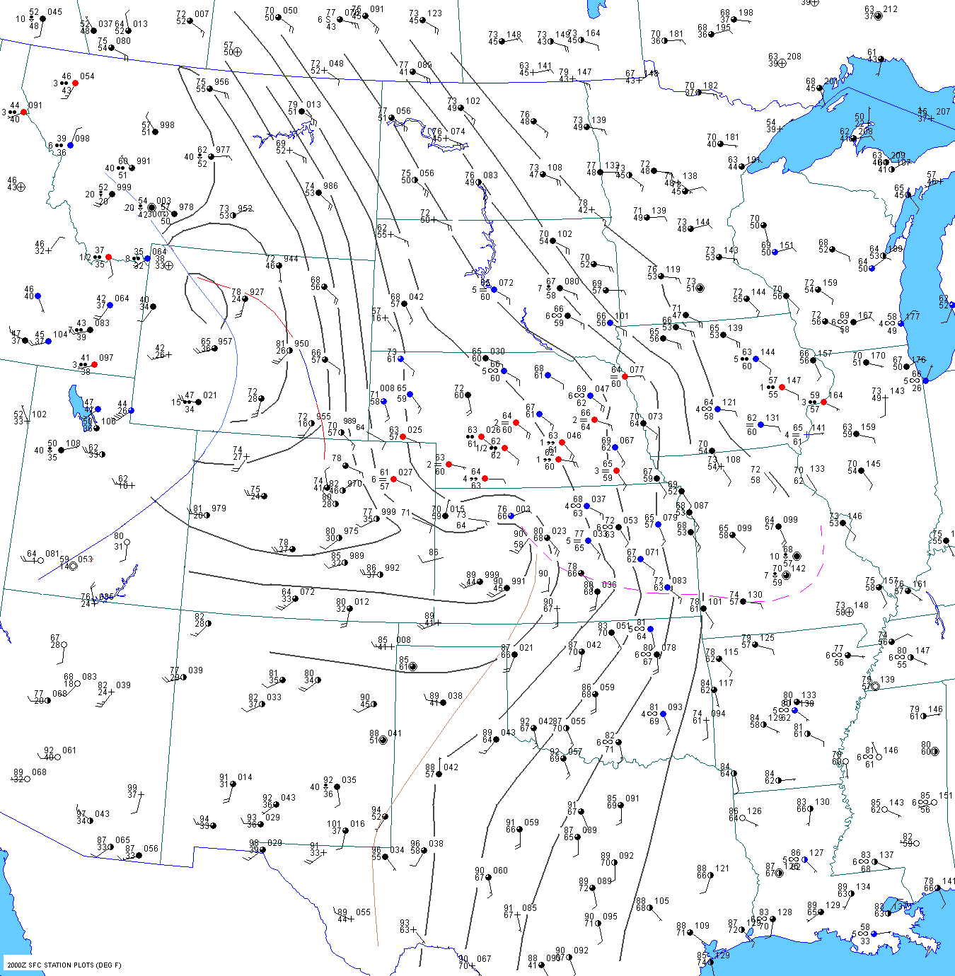
The following illustrates the important contribution
of elevated heating on the front range to theta-e. At 20 UTC, the
temperature and dewpoint(T/Td) at Cheyenne and
Dallas were 70F/57F and 85F/69F respectively. Despite the
temperature and dewpoint being 15F/12F higher
at Dallas than at Cheyenne, the theta-e was actually higher at
Cheyenne. This is because the potential temperature was 106F at
Cheyenne compared to 87F at Dallas. Keep in
mind that a dewpoint of 57F at Cheyenne has the same
amount of moisture as a 63F dewpoint at Dallas. So on
a "level playing field", the dewpoint was about 6F
higher at Dallas, resulting in a mixing ratio that was 24% higher.
Obviously elevated heating more than compensated for
the moisture deficit at Cheyenne.
| 20 UTC |
Elev(ft) |
Pres.(mb) |
SLP(mb) |
T(F) |
Td(F) |
MR(g/kg) |
theta(F) |
theta-e(K) |
| Cheyenne |
6140 |
796 |
998.9 |
70 |
57 |
12.6 |
105.6 |
353.5 |
| Mcalester |
600 |
982 |
1009.3 |
81 |
69 |
15.7 |
83.8 |
348.5 |
| DFW |
530
|
988 |
1009.1 |
85 |
69 |
15.6 |
86.9 |
350.2 |
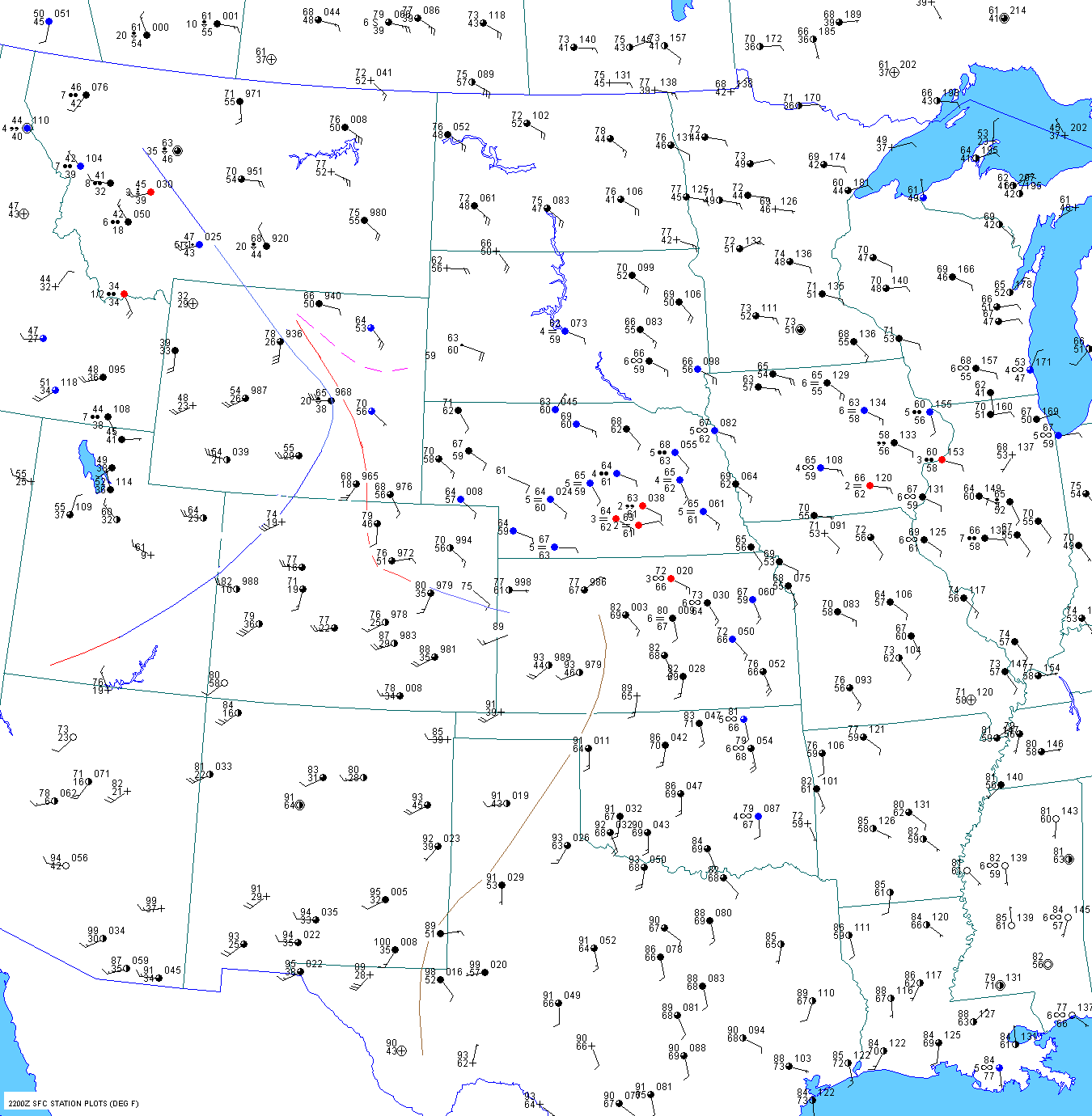
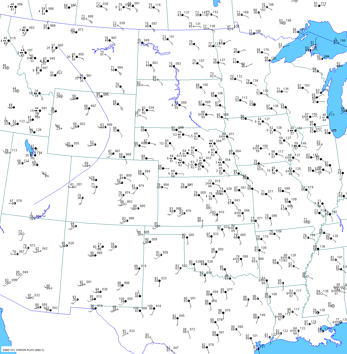
Late Afternoon
At
22 UTC the cold front was surging through Casper, WY. The front was passing through Worland at 22 UTC. It
The
observation at Worland was time stamped 2150 UTC but was probably make
prior to this. Instead of analyzing
the front southwest of Worland, I put the front
right over them at 22 UTC.
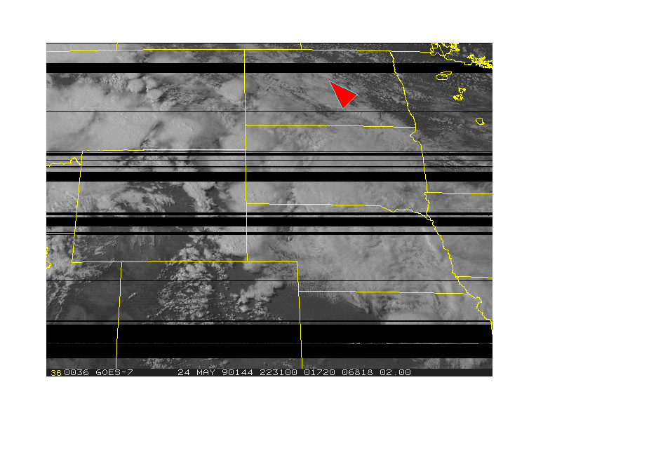
The
2230 UTC visible shot indicated a line of cloudiness developing along or just ahead of the pacific cold front along
a line from Big Horn county southeast to near
Casper. However, notice that there is a storm out ahead of this cloud
band. This storm may have been the one that produced
a
tornado 6 miles west of Wright at 2335 UTC and north of
Wright at 2349 UTC. The
23 UTC and
00 UTC surface charts suggest that the tornado at 2330 UTC was out
ahead of the cold front. Keep in mind that
paralax errors are present in these satellite images. Another
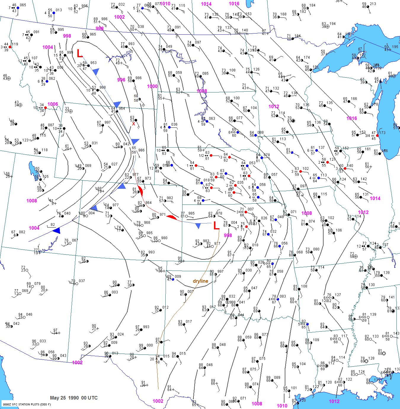
tornado was
observed at 0030 UTC near North Butte in southwest
Campbell county. This storm must have occurred along or
immediately ahead of the pacific cold front. The
frontal position from hour to hour through 00 UTC is shown
here.
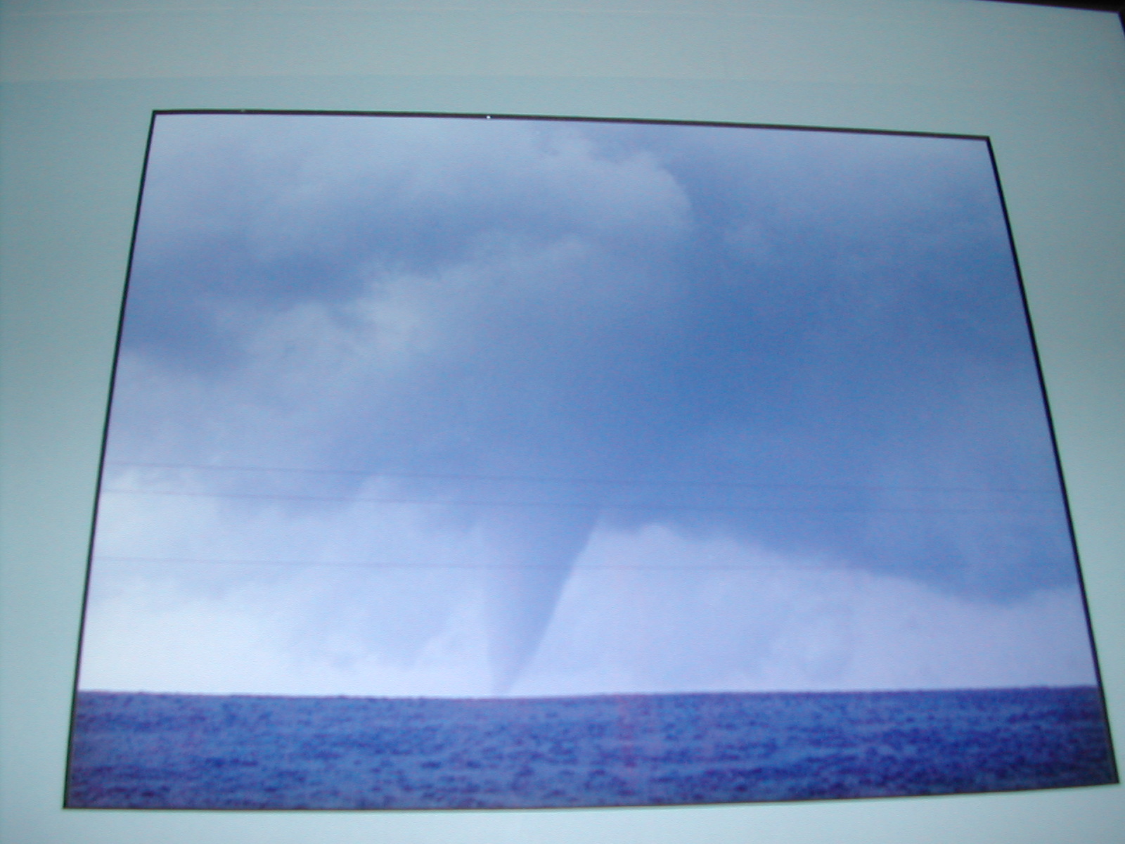
This tornado picture was taken by a Dalene Moore.
Her
husband is a cooperative observer for the Rapid City NWS.
Several storms were also occurring in central and
north central Montana at
2230 UTC but no severe weather was
reported with these storms.
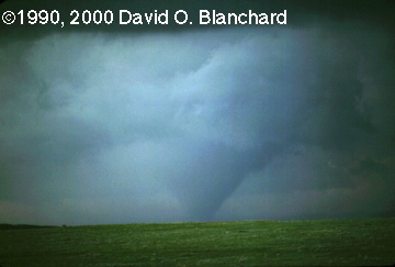
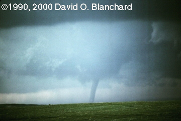
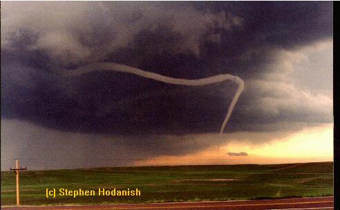
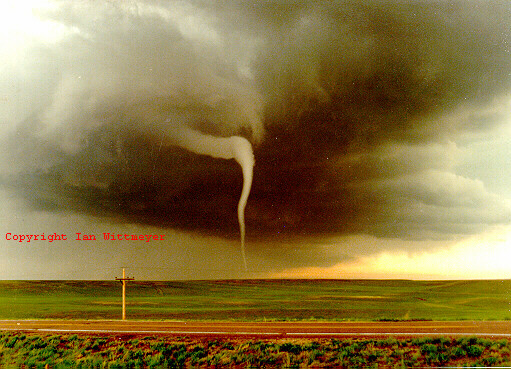
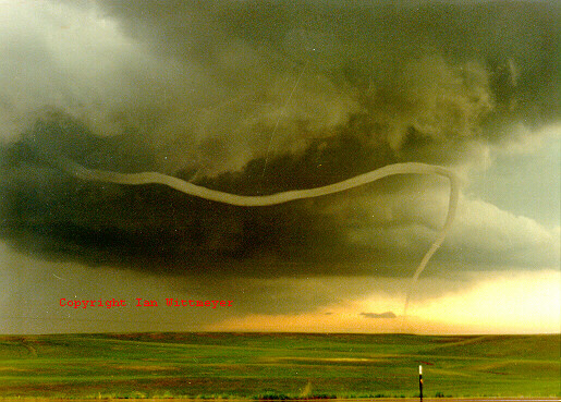
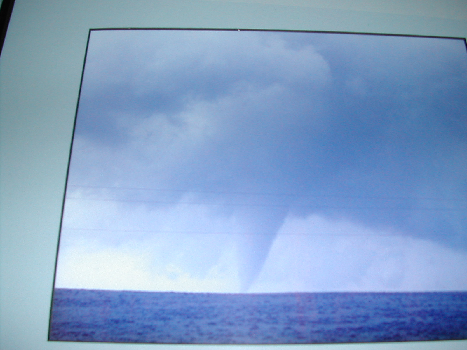
A picturesque rope
tornado and a larger tornado occurred in southeast Wyoming around 23 UTC. The
larger tornado
was photographed by Dave Blanchard while the
beautiful rope
tornado was photographed by Ian Wittemeyer and
Steven Hodanish.
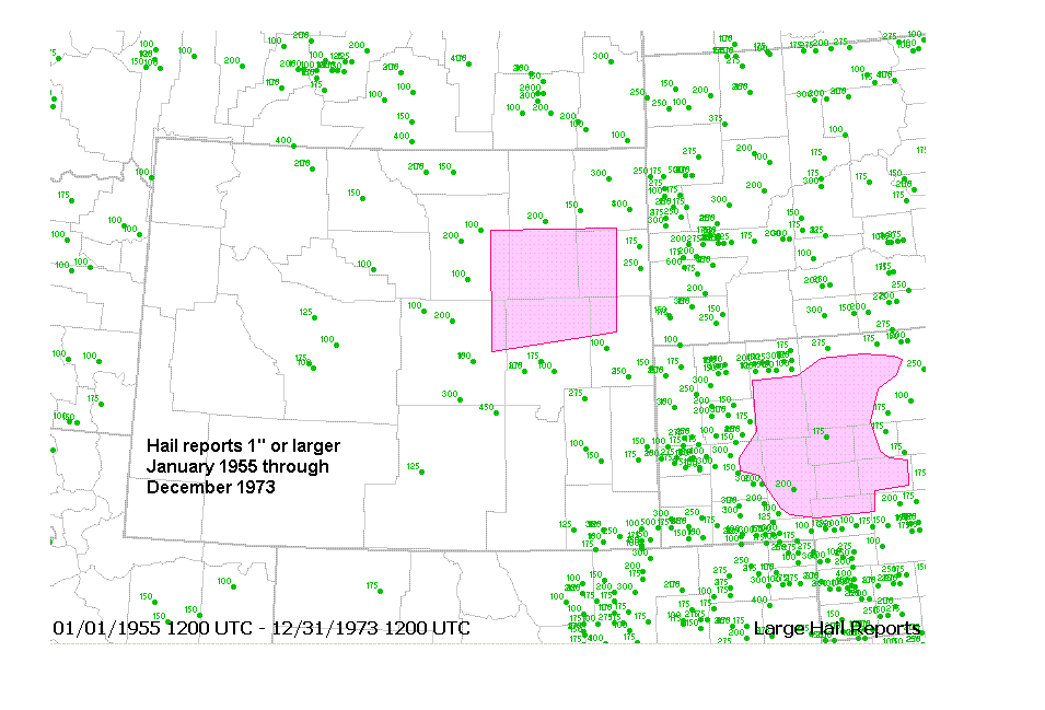
There were only 5 reports of severe hail in Wyoming
on May 24 1990, and 4 of these were in Laramie county. No
large hail was reported with the storms in northeast
Wyoming. This is not surprising given that this
region is desolate,
with only 2 small towns over a 6,000 sq. mi. area.
From January 1955(beginning of hail records) to December 1973.
there were
no hail reports larger than 3/4" in this huge, unpopulated area. There were a few hail reports from 1974 to
1992 that were clustered near Wright along highway
59.
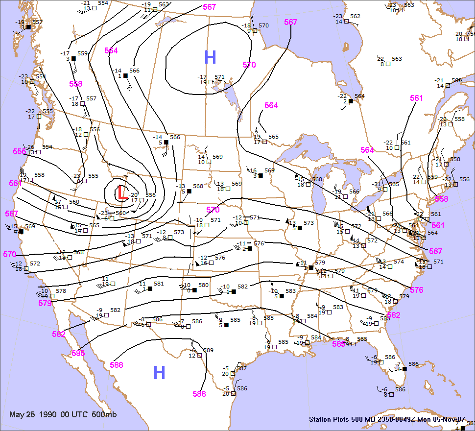
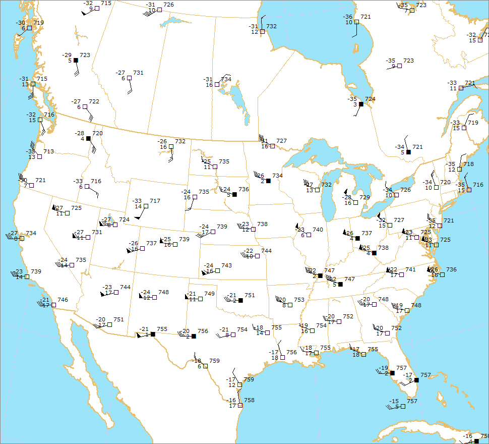
At 00 UTC, the center of the
500mb low was just east
of Pocatello, ID (550 dm). The 500mb temperature at
Glasgow, MT was -14C and this is probably similar to
the 500mb temperature near the northeast Wyoming tornadoes.
A shortwave trough was apparently located over western Kansas. The 500mb flow over central Kansas was
moderately strong (50kts)
and veered to the west-southwest. The 700mb warm plume had shifted
back to the eastern
Rockies by 00 UTC, with
700mb temperatures of 13C at Denver and 15C at Albuquerque. The 700mb wind speeds
across Kansas were strong with
35 kts from the southwest at Dodge City and Topeka. The 850mb wind
at Topeka
was a strong 40kts. Other charts:
400mb 300mb
Dewpoint
depressions were not all that high in the dry air. So we can't assume
like we have in other cases that the
thermal
profile in the dry air was dry adiabatic from the surface to 500mb.
Nevertheless, it appears that the low to
mid levels were close to dry adiabatic at least through 700mb.
| 18 to 20 UTC |
Elev(ft) |
Pres.(mb) |
SLP(mb) |
T(F) |
700mb T |
500mb T |
Casper
|
5300 |
817 |
1000 |
77-81 |
12 |
-14 |
| Rawlins |
6813 |
787 |
1004 |
72 |
11-13 |
-14 |
| Worland |
4227 |
853 |
1010.1 |
78-82 |
10 |
|
| Laramie |
7270 |
768 |
1011.9 |
72 |
13-14 |
-12 to -13 |
| Eagle |
6540 |
782 |
|
75 |
13 |
-13 |
| Aspen |
7820 |
749 |
|
68 |
14 |
-12 |